Last September, nearly everyone in Washington got a painful reminder of the threat wildfire smoke poses to their health. The Labor Day fires across much of the west led to a massive plume of smoke that blanketed all of Washington and lingered for more than a week, with record-breaking levels of particulate pollution.
During major smoke events, our Air Quality team works overtime to provide current air pollution readings from our network of more than 70 monitoring stations across the state, along with smoke forecasts, analysis from our atmospheric scientists, and information on burning restrictions. As the 2021 smoke season draws closer, we'll add a new air quality mobile app to that information arsenal, making it easier for people to get the information they need to protect themselves while on the go.
“During the 2020 smoke storm, our air quality monitoring website received more than 2 million hits a day. Of those visits, more than 60% came from mobile devices,” said Chuck Pierce, information technology manager for Ecology’s Air Quality program. “This new app is going to be a real positive thing for the public.”
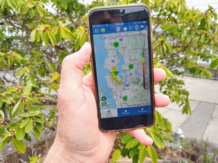
The new mobile app is available on both the Apple App Store and the Google Play Store under the title, “AirQualityWA.”
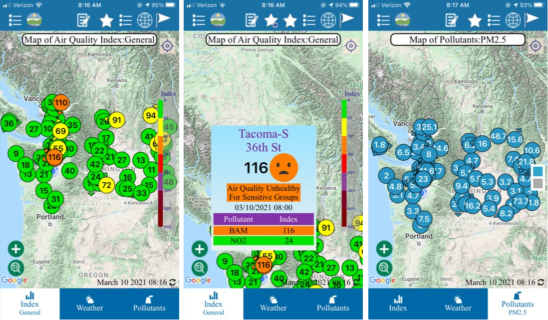
The home screen features the “dot map” of color-coded current conditions for each of the monitoring stations. Each “dot” carries a number that represents the current Washington Air Quality Advisory level (WAQA). The WAQA values are similar to the national Air Quality Index system, or AQI —but are more protective of human health, meaning a WAQA map will often show a higher warning level than the comparable AQI map.
While Ecology’s full air quality monitoring map can also, of course, be viewed from a mobile phone, the app loads more quickly and its display and navigation is optimized for smaller screens.
And, even though current conditions are what most people come to Ecology’s air quality maps for, Pierce thinks the app has other features the public will find useful:
- People can choose favorites, for instant access to their local monitor or one near a family member.
- There are a variety of reports available, such as 24-hour summaries, highest pollution values, and rolling averages.
- Users can toggle between specific types of air pollution — fine particulate matter, or PM2.5, is the most common, and the primary concern from wildfire smoke, but Ecology also monitors for PM10 (slightly larger particulates), ozone, carbon monoxide, nitrogen oxides, and sulfur dioxide.
Pierce said his team has been working with developers on the app for more than a year, but he wanted to complete the project and make it available to the public well before wildfire season, when public demand is the greatest. The monitors operate continuously, though, and current air quality information can also be useful during wintertime temperature inversions, which trap air pollution close to the surface, or if there is a local fire or other emergency that affects air quality.
“The goal is to make the data as accessible as we can to people,” Pierce said, “so I hope this app gives the public the information they’re looking for, and the information they need.”
Download the app
Apple iOS: Air Quality WA - iOS
Google Android: Air Quality WA - Android


