

River & stream flow monitoring methods
Hydrologists measure how much water is in Washington's rivers and streams. The information is used to help manage water supplies, releases, and diversions in support of fish, farms, and domestic water needs across the state.
A basic description of the way streamflow is calculated can be found below.
Standard Operating Procedure for Measuring and Calculating Stream Discharge - EAP056 is the official document describing streamflow methods in detail.
Hydrologists confirm streamflow in the field
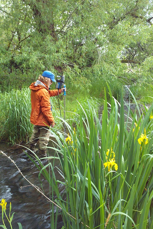
Scientists visit streamflow monitoring sites about once every six weeks. They measure flow to confirm rating predictions or further develop the rating curve. In most conditions they measure streamflow with hydroacoustic equipment. These instruments include an Acoustic Doppler Velocimeter, called an ADV or an Acoustic Doppler Current Profiler, known as an ADCP. Typically used in smaller streams, ADVs bounce pulses of sound against moving particles in the stream to measure velocity. The ADCP is moved across larger streams on a raft. The ADCP measures stream depth and water velocity and almost instantaneously calculates streamflow. The change in the frequency of reflected sound (the "Doppler Effect") allows these instruments to calculate velocity and streamflow very accurately.
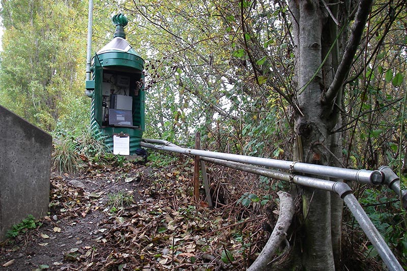
Hydrologists also perform maintenance or repairs on the equipment. They confirm the stage to maintain calibration of the data logger using a physical index that may include a staff gage, usually one or more porcelain enameled steel plates mounted to a secure structure; a wire-weight gage attached to a bridge, or a laser level mounted at a fixed elevation. Most stations are equipped with secondary or backup gage indices.
In addition, with the use of survey equipment, hydrologists periodically confirm the relative elevations of the physical stage indices (staff gages, wire weight gages, etc.) and determine if movement of these gages has occurred over time.
Findings from each visit to a streamflow gaging site, including any changes in the rating curve, are reported in the technical notes for that site, published with the streamflow site data and available in a tab on each flow monitoring network page.
Related links
Contact information
Jim Shedd
Hydrologist, Streamflow Team Lead
jim.shedd@ecy.wa.gov
360-522-2885