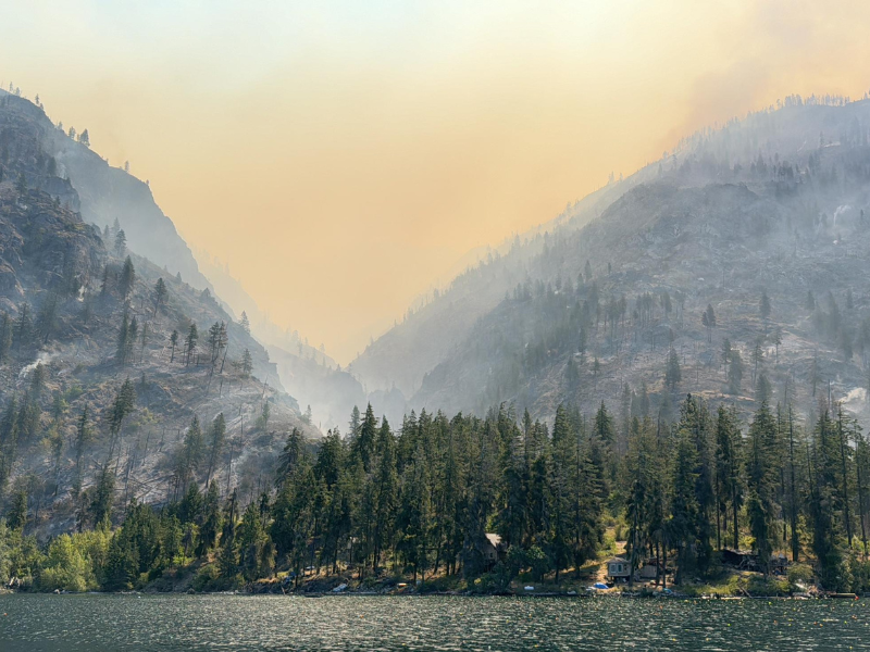
Smoke from the Pioneer Fire hangs above homes on Lake Chelan.
It’s been an eventful wildfire season in Washington, and it’s not over. The town of Stehekin, pinned between Lake Chelan and the ongoing Pioneer Fire, faced days of advancing flames before recently emerging from level 3 (“get out now”) evacuation orders. Yakima County and southeastern Washington experienced multiple days of unhealthy, very unhealthy, and hazardous air quality index (AQI) values resulting from several different fires. Large wildfires continue to burn from the North Cascades down to Mount Adams, some prompting road closures and evacuations.
One of our key responsibilities is to track the concentrations of fine particle pollution (PM2.5) found in wildfire smoke and share this information with the public. That’s because exposure to PM2.5 brings serious health concerns, especially for children, adults over 65, and people with respiratory or heart conditions. Knowing the current and predicted air quality conditions allows people to better protect themselves and their families.
Every summer, we reinforce the state’s robust monitoring network in the communities most likely to experience wildfire smoke. Deploying additional sensors allows community members to access more localized air quality information, especially during the late summer peak of wildfire season.
Deploying the latest technology
Sean Hopkins, Smoke Team Lead at Ecology’s Central Regional Office (CRO), explained that the air monitoring team places these sensors in areas where additional air quality information is most urgently needed. For example, the CRO team recently installed a sensor in Entiat, just south of Lake Chelan, in response to the 38,000-acre Pioneer Fire.
“There’s a few more locations we’re looking at, and I’d like to get the sensors up in the next couple weeks because they’re useful when the schools go back,” Hopkins said. “It’s still early in the season…we’re going to see new fires pop up into September.”
The type of sensor being installed is called a “SensWA.” Developed by Ecology, SensWA are small, portable, and easy to maintain. They monitor fine particle pollution (PM2.5), the criteria air pollutant of greatest concern statewide. Before wildfire season, each of our regional offices receive a small supply of SensWA to deploy as needed once the smoke picks up. SensWA are simple to install and more accurate than other low-cost sensors, making them the perfect tool for emergency wildfire smoke monitoring.
To access air quality information from all the newest sensors and monitors across Washington, check Ecology’s AirQualityWA map. Data from new sensors will appear immediately on Ecology’s map but may take slightly longer to show up on EPA’s Fire and Smoke map.
Forecast for the rest of the season
Despite the recent cool weather across Washington, warmer conditions will likely return next week. And despite recent rainfall, most of the state remains drier than normal. Fire activity and smoke impacts are expected to continue, potentially into October. Wildfire danger is still high in many of Washington’s parks, forests, and other outdoor spaces, meaning visitors should take extra care to avoid creating sparks. Some areas may also be affected by smoke from fires in Oregon, Idaho, and British Columbia.
Health and safety reminders
If your community experiences poor air quality from smoke, remember to:
- Stay inside when possible
- Shut windows and doors
- Use fans or air conditioners to stay cool
- Run a HEPA or DIY box fan air filter
- Shut windows and doors
- Limit physical activity
- Wear a N95 or KN95 mask when outside
- Monitor the air quality conditions
- Ecology’s AirQualityWA map
- Use the smoke forecast tool to plan upcoming trips
- EPA’s Fire and Smoke map
- WA Smoke Blog
- Ecology’s AirQualityWA map

