

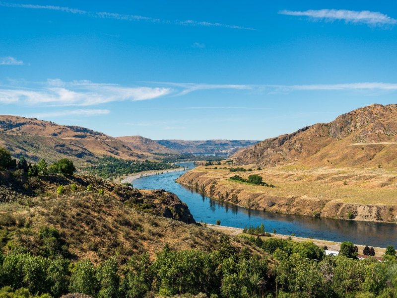
The Columbia and Snake rivers are intrinsic to the Pacific Northwest. Fed by its many tributaries, the Columbia River system forms the dominant waterway in the region, flowing across state and country borders and emptying into the Pacific Ocean. These waterways support diverse ecosystems and key species like salmon, sustaining Tribal Nations since time immemorial. More recently, these waterways have helped fuel the region’s industrial growth through hydropower projects.
Along with industry and other changes, the conditions of these rivers have shifted. The Columbia and Lower Snake rivers are included on the state's list of polluted waters, primarily due to high water temperatures that exceed state water quality standards and pose a threat to salmon.
We invite you to join us virtually on March 17, 2025, to learn more about our efforts in developing a strategy to achieve healthy water temperature within the Columbia and Lower Snake rivers.
Tools to get to cool, clean water
As part of our water quality work, we set goals for waterbodies to support designated uses such as recreation or protecting aquatic species. To support these goals, we define the conditions or maximum level of pollutants (chemicals, bacteria, and even temperature) in the water. For example, we set temperature standards in the Columbia and Snake rivers to preserve spawning grounds and migration pathways for salmon and steelhead. While the temperature standards are complex and vary in different areas of the rivers, they generally require the water to be between 60 to 68 degrees Fahrenheit (that’s 16 to 20 degrees Celsius).
Total Maximum Daily Loads (TMDLs), or water clean up plans, are a primary tool in our toolbox to tackle water quality issues, including high temperatures. By setting reduction targets for each pollution source necessary to meet water quality standards, TMDLs provide strategies to restore waterbodies to clean and cool conditions for people and salmon.
Implementing tools
However, writing a TMDL is just the first step in getting to cool, clean water. TMDLs are not self-implementing, and while they provide targets to meet standards, subsequent actions are needed to meet those targets and achieve our goal of healthy water. Though implementation plans are not required by the federal Clean Water Act, we develop them to outline the path forward. Specifically, these plans outline management goals, projects, partners, priorities, schedules, and education and outreach strategies. They also outline available technical and financial assistance opportunities, best management practices, and state and local programs and authorities to help implement the TMDL. This helps with tracking, monitoring, and evaluating the progress of the project.
While TMDLs are usually developed at the state level, the U.S. Environmental Protection Agency (EPA) published the 2021 Columbia and Lower Snake Rivers Temperature TMDL due to the rivers' multijurisdictional range. The TMDL looks at temperature issues along nearly 900 miles of river, focusing on the Columbia from the Canadian border to the Pacific Ocean. It also covers the Lower Snake River in Washington, beginning where it meets the Clearwater River at the Idaho border over to its junction with the Columbia River.
The TMDL covers nearly 900 miles of the Columbia and Lower Snake rivers.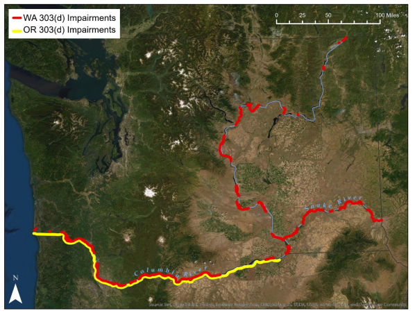
Why are the rivers warm?
The rising water temperatures in the Columbia and Snake rivers are driven by a combination of factors, with EPA’s TMDL noting primary causes as climate change and hydropower operations. Dams, as well as water withdrawals for agriculture, industry, and municipalities disrupt natural flows and can cause increases in water temperatures. Additionally, land use changes from urban development and agriculture can decrease streamside (riparian) vegetation that provides shade to help keep water cool. In other words, salmon and other fish are now in hot water.
To achieve temperatures suitable for salmon and other species, the TMDL sets a temperature limit shared evenly between three main sources: dams, point sources (like factories), and tributaries (streams that flow into the rivers). The total allowed increase in temperature from all three sources is 0.3°C, meaning each source can only contribute up to 0.1°C of temperature increase at any given location.
Our collective strategy
We are responsible for developing the implementation plan for this TMDL. Our plan will describe strategies needed to meet the limits set and outline the partnerships necessary to be successful in this work.
Throughout our implementation process, we will invite Tribes, technical experts, restoration professionals, fisheries managers, and the public to collaborate on actionable solutions to reduce water temperature within the basin. Mirroring our process for other TMDLs, a technical advisory group will be formed to evaluate potential solutions included in the final plan. Throughout 2025, we will host a series of public workshops focused on key components of the TMDL as we develop the implementation plan.
The issue of temperature across the Columbia and Lower Snake rivers is complex and requires creative and innovative strategies. We recognize that this implementation plan is just one of several initiative across the state aimed at improving water quality issues on the Columbia and Snake rivers and we will coordinate our plan with these other efforts.
Interested in getting involved?
The Columbia and Snake rivers provide vital habitat for salmon and also support industries and hydropower across the region.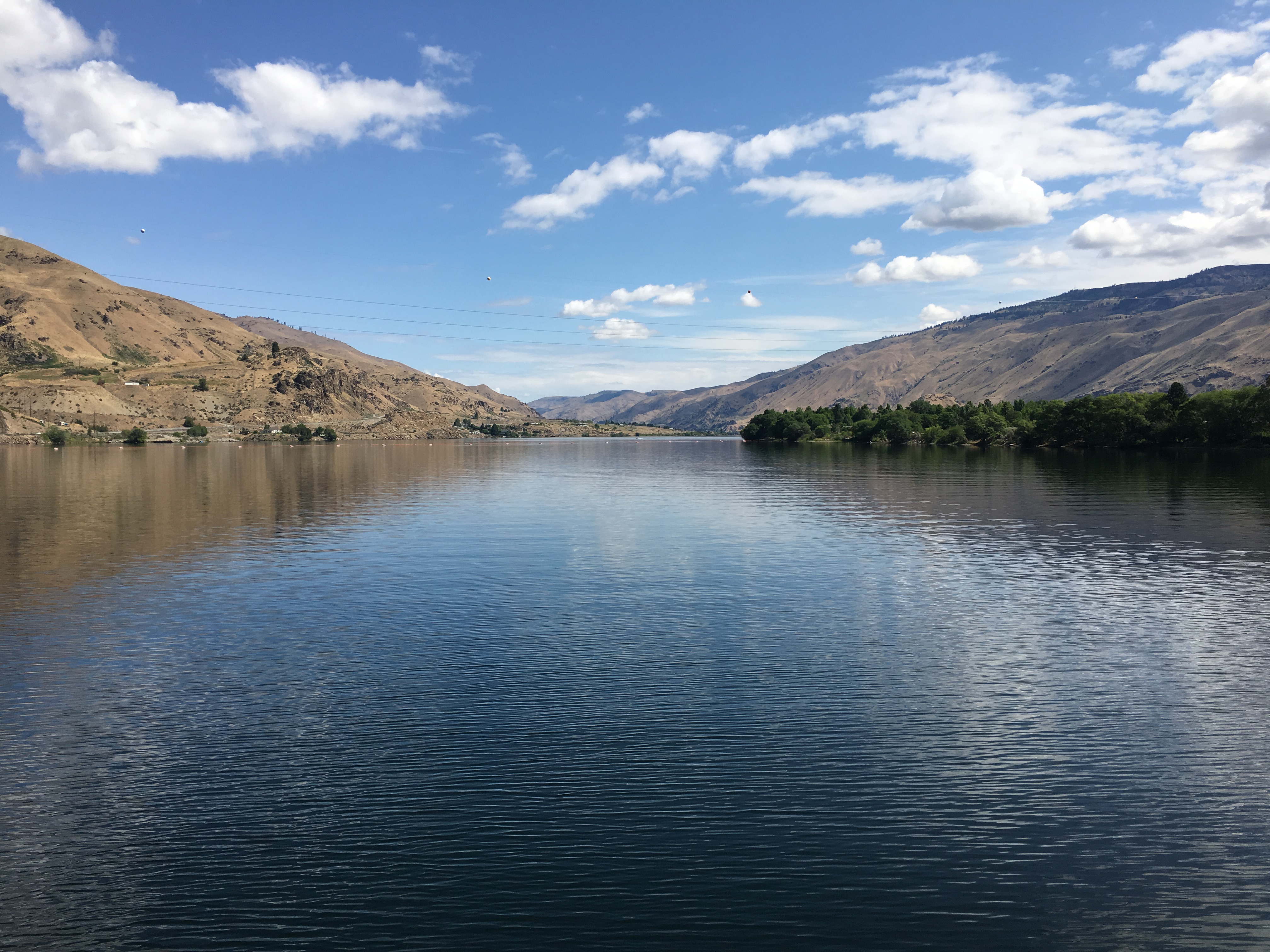
We are committed to work alongside Tribal, local, and state partners to address temperature sources and implement solutions that support people and salmon. This work requires collaboration.
Join us at our upcoming meeting to learn more about the history of this work and our plans to develop an implementation plan for the Columbia and Lower Snake Rivers Temperature TMDL.
Meeting details:
- Monday, March 17, 2025, from 1:30 p.m. to 3 p.m.
- Register for the meeting on Zoom