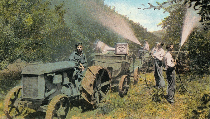
In the early 1900s, lead arsenate was the most widely used pesticide in the U.S.
Between 1900 and 1950, a pesticide called lead arsenate was extensively used to control codling moth infestations on fruit trees throughout Central Washington. This resulted in lead and arsenic contamination in the soils of historic orchard lands, particularly in Yakima, Chelan, Douglas, Okanogan, and parts of Benton counties.
Nearly 115,000 acres of land in Central Washington have been identified as historic or former orchards that may be tainted by lead and arsenic. This is concerning because lead and arsenic persist in the environment and remain a potential health threat, especially to children.
Over the past few years, as more of these properties are being developed, community members and developers have raised concerns about potential contamination.
Addressing lead and arsenic in Central Washington
In 2020, we convened the Legacy Pesticides Working Group to address these concerns, with representatives from banking, health, real estate, local government, and homebuilders. Meeting in subcommittees, they produced new guidelines, requirements, and remedies that will help homeowners and developers in Central Washington understand risks associated with living on historic orchard properties and ways to make properties safe.
New maps available
First, it’s important for people to know if their property is on former orchard land.
Working with the city of Yakima’s mapping department, we looked at aerial photos taken by the U.S. Geographical Survey during the time period lead arsenate was used.
The historic aerial photos tell us a story. Experts at the city examined the aerial photos to closely identify lands used as orchards. Based on the timeframe of these historical photos, we were able to ascertain lands that may be contaminated.
Experts analyzed the photos using “geographic information systems” (GIS) and created maps identifying potentially contaminated properties. Once data were analyzed, maps were designed to show the information visually.
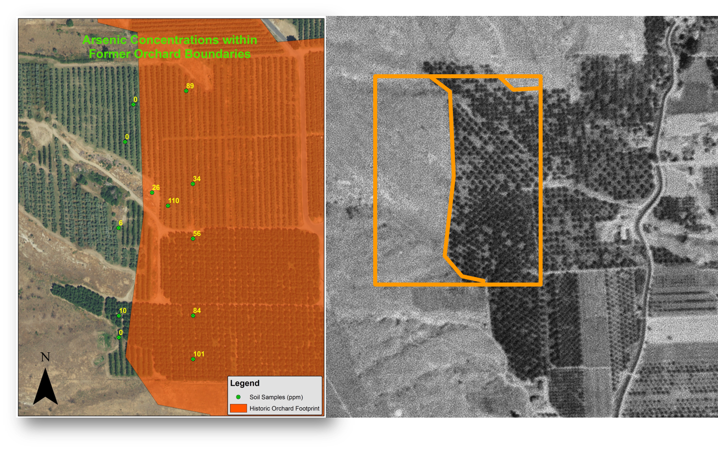
The old black-and-white aerial photo in this image shows where an orchard existed in Chelan County before 1950. The image on the left shows the current extent of orchard on the same property (the orange area highlights the compared photos).
How the maps help us understand soil contamination
When we take soil samples at a site, our staff tests soil using a technology called XRF (X-Ray Fluorescence). This allows us to detect and measure the concentration of different elements in the soil, including lead and arsenic.
We know that lead and arsenic are typically found in the top two feet of soil, don’t break down or degrade over time, and are not absorbed by plants. We also know that lead and arsenic accumulate in the body over time and can cause long-term health issues — especially to children or those who experience long-term exposure.
That’s why these maps are an important tool to inform people about their property and help them proactively protect themselves and their families.
How to find the maps and use them
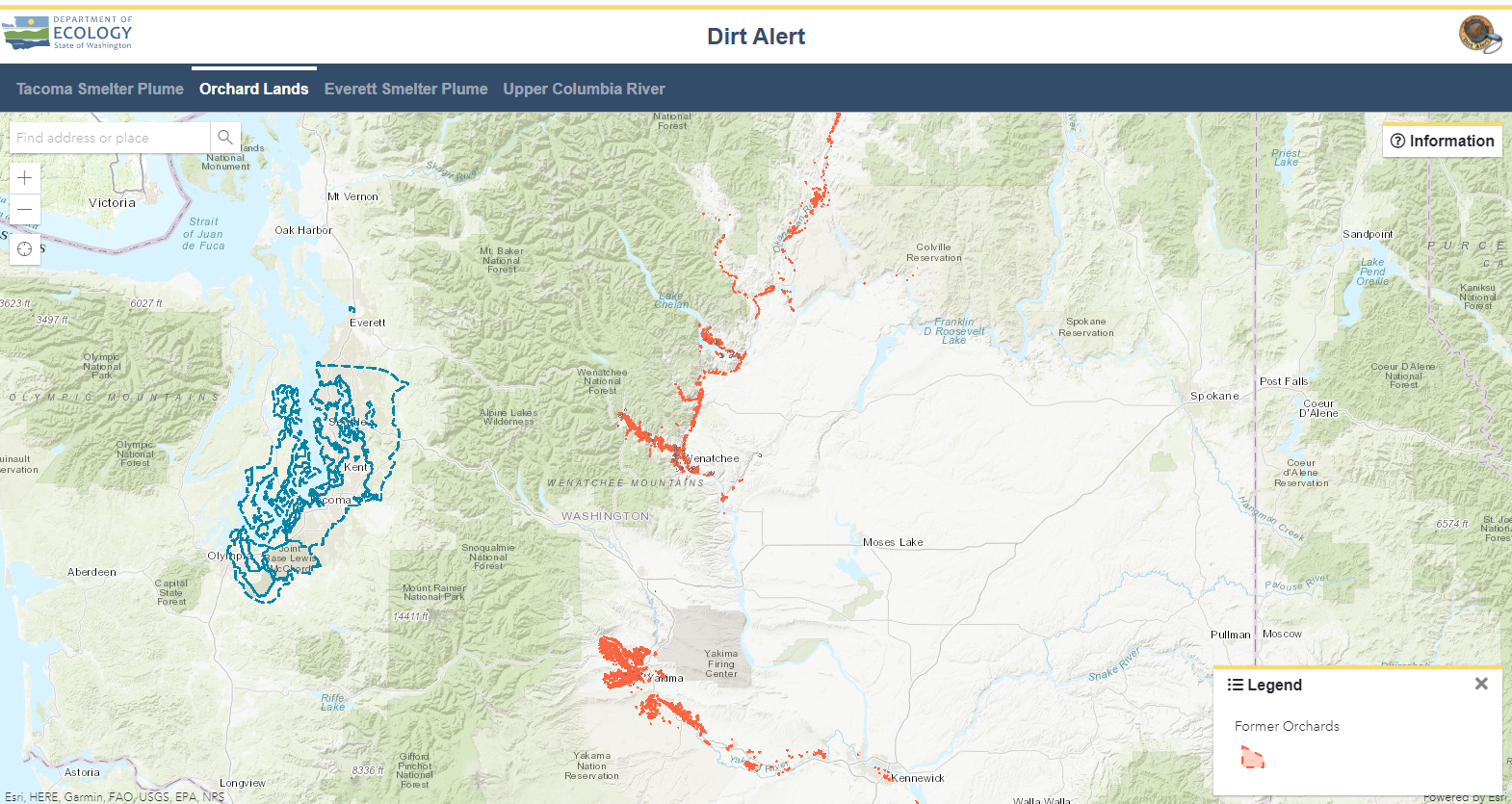
We created a new webpage with more information on historic orchard lands and links to the searchable historic maps. Just enter your address, and information about your property and how to get soil testing is provided. The images below show what the searchable maps look like and the kind of information provided for each property address. Note: The interactive maps are compatible with all common internet web browsers except Internet Explorer.
What to do if your property is on the map
If you enter your address in the search bar and the GIS layer shows that your property was an historic orchard, there are several steps you can take.
- Email us to set a time for free soil testing.
- After testing, if lead or arsenic levels are detected, we will suggest next steps.
- Start taking healthy actions now with these simple steps.


