

Washington's marine spatial plan
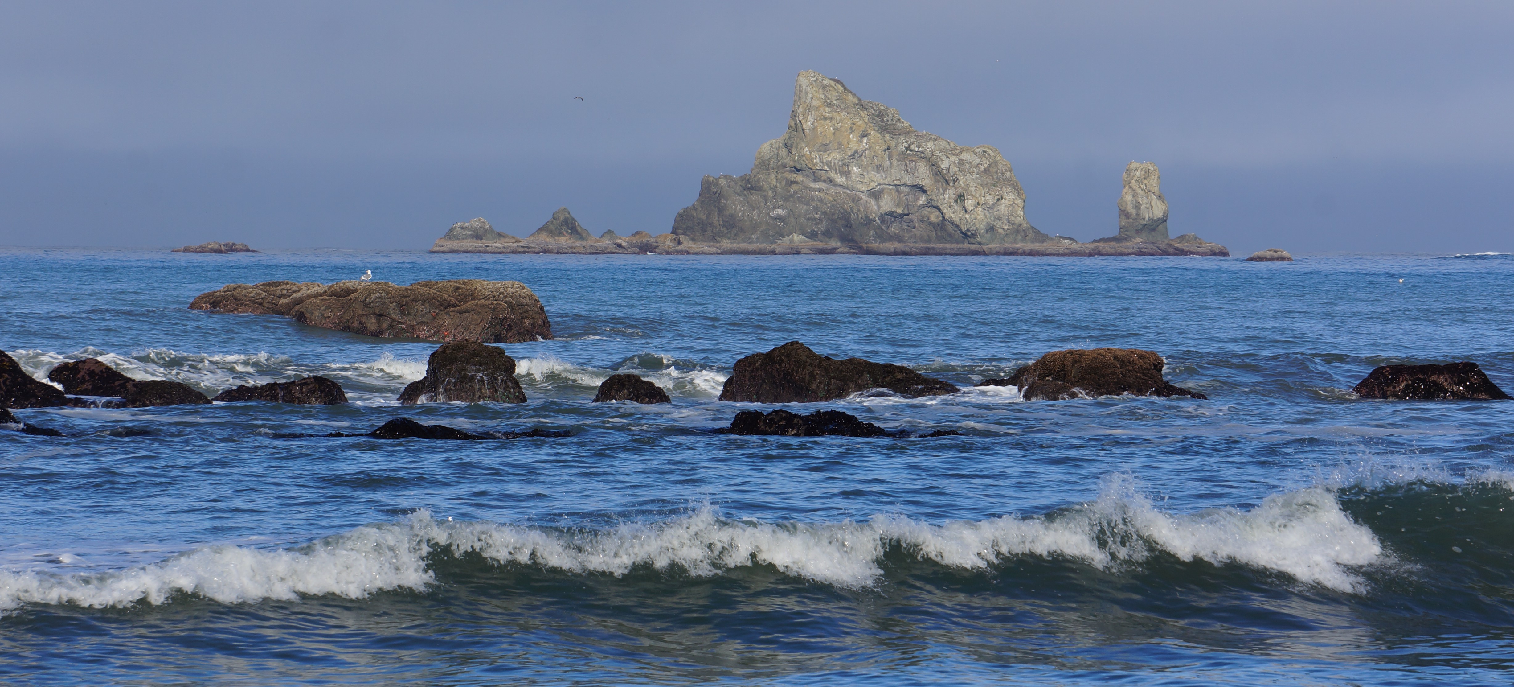
Marine spatial planning is an integrated approach for managing human activities in the marine environment to ensure a resilient and healthy Pacific Ocean coast that supports sustainable economic, recreational, and cultural opportunities. Coastal communities and Tribes have a rich history and unique, ongoing relationship with the state’s marine and coastal resources.
However, increasing demands on Washington’s ocean resources, including new projects and uses, may lead to conflicts. The marine spatial plan for Washington's Pacific Coast was adopted in 2018. This science-based guidance document establishes a state process for reviewing and making decisions about potential new ocean uses. The plan includes enforceable policies and guidelines that regulate new ocean uses to protect sensitive ecological areas and preserving existing uses.
We retired the stand alone marine spatial planning website (msp.wa.gov) and the integrated mapping application. Content that was on the website was migrated to Ecology’s and the spatial data is now accessible through the Washington State Coastal Atlas.
Using the marine spatial plan
The marine spatial plan should be used for proposals for new ocean uses along Washington’s Pacific Coast. The plan applies to all stages of decision-making to protect existing ocean resources and uses from adverse environmental impacts.
When and where does the plan apply?
The Marine Spatial Plan applies to new ocean uses and activities not previously permitted or authorized such as:
- Ocean energy projects
- Dredging or dredge disposal
- Installation of underwater infrastructure
- Offshore aquaculture
- Seabed mining
The marine spatial plan applies to state waters off Washington's Pacific coast, spanning from Cape Flattery to the mouth of the Columbia River, including Grays Harbor and Willapa Bay. Its study area extends 35 to 55 nautical miles offshore, reaching a depth of 700 fathoms (see map for reference). It does not apply to Puget Sound or Strait of Juan de Fuca.
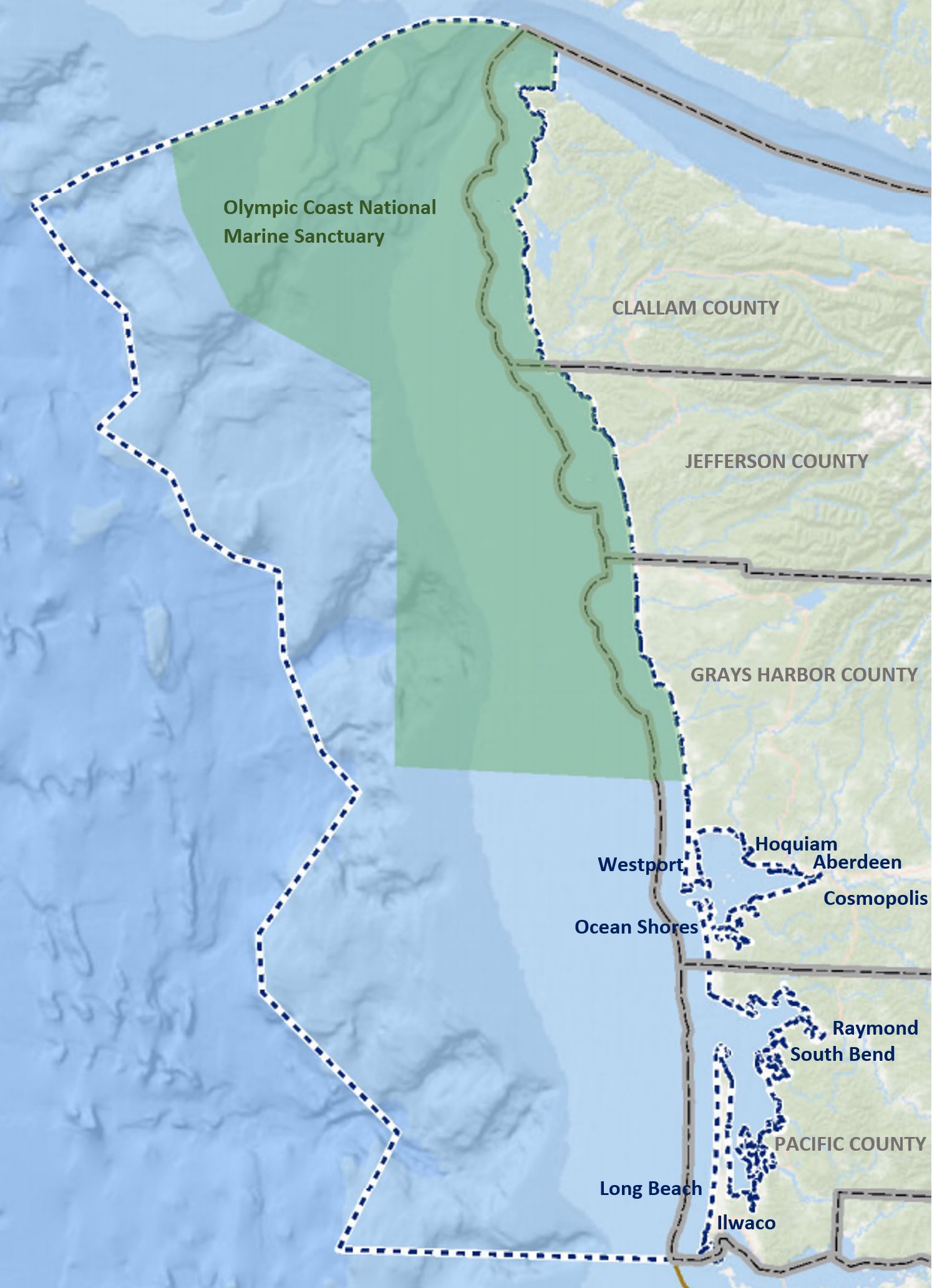
Washington's Marine Spatial Planning study area outlined in the white and blue dotted line.
Research, data, and information
Washington’s marine spatial plan contains data, information, and analyses to help local and Tribal governments, state and federal agencies, and project proponents make informed decisions about project development, marine planning, and other ocean and coastal management decisions. The plan includes:
- Baseline information about Washington’s ecology, ocean and coastal uses and resources, climate change effects, and potential new uses that would trigger the plan (Chapter 2).
- Spatial analyses of existing uses, biological resources -- including seabird and marine mammal distributions, and characterization of ecologically important areas (Chapter 3).
- More than 50 individual maps designed to improve a baseline understanding of the marine spatial plan’s study area (Appendix A).
The marine spatial plan also includes information from various other studies such as socioeconomic and ecological indicator reports, seafloor mapping, and recreational use studies. Most of this information is found on our Ocean data and research page.
Management framework
The marine spatial plan (Chapter 4) outlines a management framework that includes the process and substantive requirements based on existing state laws and policies, as well as the need for Tribal consultation. It offers guidance and recommendations for applicants, agencies, and third parties about how to effectively use the plan, including:
- Identifying ecologically sensitive resources to be protected.
- Policies designed to protect fisheries from long-term adverse impacts offshore development poses to the resource and ensure reasonable steps are taken to avoid and minimize such impacts.
- Detailing the data, information, and planning necessary for proposed projects.
- Specifying the effects to people, communities, Tribal shared resources, and the environment that need to be evaluated, including state standards and policies.
- Listing various state and local authorizations proposed projects may need to obtain such as shoreline permits and use authorizations for state-owned aquatic lands.
- Creating a process for enhanced coordination with stakeholders, Tribes and state and federal agencies.
This essential information and the processes outlined in the marine spatial plan are designed to help agencies evaluate whether a new ocean use project meets state Ocean Resources Management Act requirements. The management framework can also help Tribal governments determine whether a new ocean use project may have direct, indirect, or adverse cumulative impacts on Treaty-protected resources.
Important information for project proponents
Before applying for a new ocean use, project proponents should reach out to Ecology to discuss a range of topics, including:
- Project and site-specific information
- Potential impacts and evaluation of coastal effects
- Permitting needs
Project proponents will likely need an array of different local, state, and federal permits and authorizations. Applicants should work with the proper planning and regulatory authorities and consult with affected Tribes. Early engagement will help identify these needs and help ongoing communication.
Additional information about the Marine Spatial Plan
The State Ocean Caucus and Washington Coastal Marine Advisory Council were both heavily involved in the developing the state’s marine spatial plan with support from federal agencies, academic institutions and non-governmental organizations.
Contact information
Casey Dennehy
Marine and ocean planner
casey.dennehy@ecy.wa.gov
360‐688-0142