

Puget Small Streams study
Stormwater Action Monitoring (SAM) conducts status and trend monitoring in Western Washington streams to answer how stormwater runoff from a broad range of urban conditions affects the health of small wadable streams.
Study goals
Stakeholders, including municipal stormwater permittees in Western Washington, want to know how urban stream health changes over time as the area urbanizes and stormwater controls are implemented more broadly.
Study design
This monitoring is designed to assess the current stream conditions and answer the question: Are the quality and biota conditions of receiving waters in the region improving with broad implementation of required stormwater management practices?
The Puget Small Streams study collects water and sediment chemistry, in-stream and riparian habitat information, benthic macroinvertebrate, and periphyton samples. Streamflow and temperature are continuously monitored at each site.
In 2020, we launched SAM's new Puget Sound long-term stormwater monitoring program to improve efficiency and statistical power. Learn more about the design in our study design fact sheet. Detailed information about the study design, sampling schedules, and more is in the Quality Assurance Project Plan (2020).
Water chemistry, sediment, and watershed health data are available for download from our EIM database. Continuous water level and temperature data are available from USGS's ScienceBase Catalog.
Study findings
Previous monitoring in 2015 found that urban development had a negative impact on nearly all stream health indicators. Key stressors included physical habitat characteristics, such as canopy cover, urban development, and sediment chemistry. See the factsheet and completed studies list below for more detail.
Sampling locations
Sampling sites are randomly selected to represent the full range of urban and urbanizing conditions across the Puget Sound region. Each year we visit 33 stream sites and two least-distrubed reference sites. To improve trend detection power, we return to each site two more times at five-year intervals. Open the map below to explore the current sampling locations.
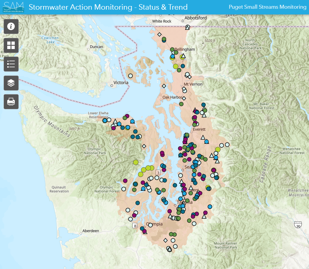
Puget Sound small streams study sampling locations. You can find detailed information for each site in the attribute tables. You can view the full size ArcGIS online map here.
On-going study contracts
Completed studies list
Related links
Contact information
Chelsea Morris
Stormwater Action Monitoring Scientist
chelsea.morris@ecy.wa.gov
564-999-3052