If I were writing this blog two weeks ago, I’d be telling a very different story.
Before the infamous 2019 snowpocalypse hit, some of the state’s water supply experts were experiencing mild heartburn over the outlook of water supply for the year. We were at 74 percent of normal snowpack. That’s the seventh-lowest season of snowpack at that point in the past three decades. But then, to the dismay of school officials but the delight of water managers, Mother Nature decided to bring it on.
Big snow
We love snow at Ecology. It’s critical to the state's mountain snowpack that feeds rivers and reservoirs and the majority of Washington's electricity is produced through hydropower.
There was a huge amount of snow that landed across the Cascades. How big was the bump in snowpack? About twenty percent. A huge jump in just a few days, and for mid-February, unprecedented at some locations.
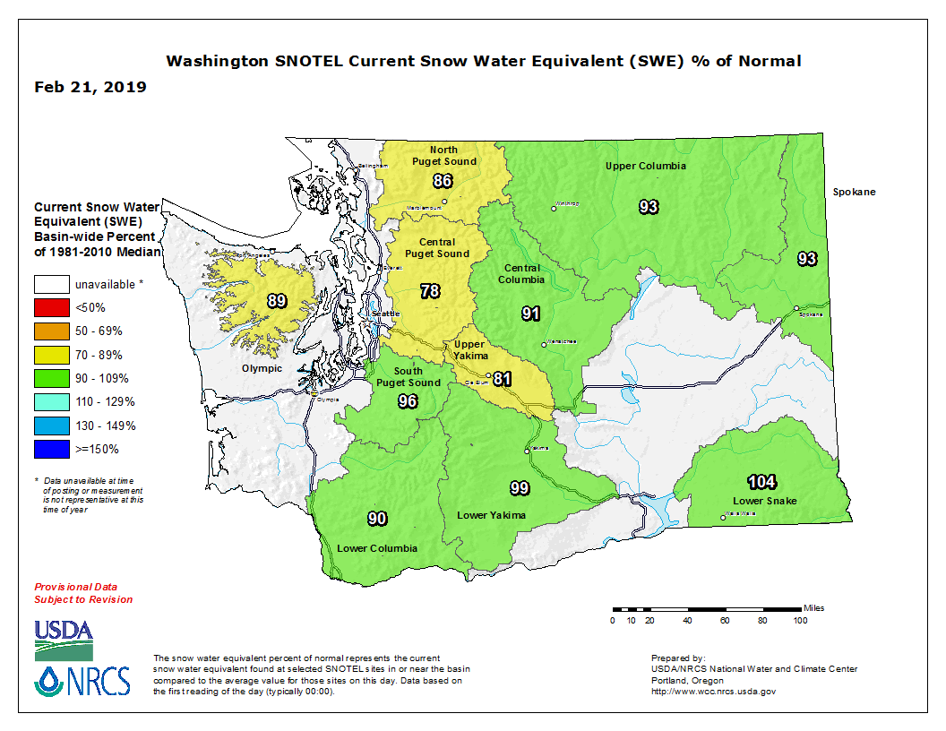
The statewide average for snowpack is now at 91 percent of normal. If this were baseball, you could say we just had a five-run inning.
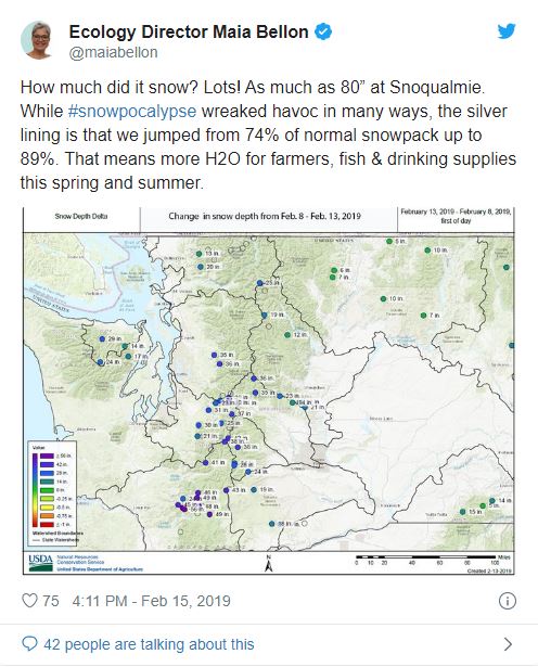
We received so much snow the director of Ecology took to Twitter to share just how much actually hit the slopes. It was massive.
See the map she included. It illustrates just how much snow measured at various sites around the state.
Snowpack is Washington's largest reservoir
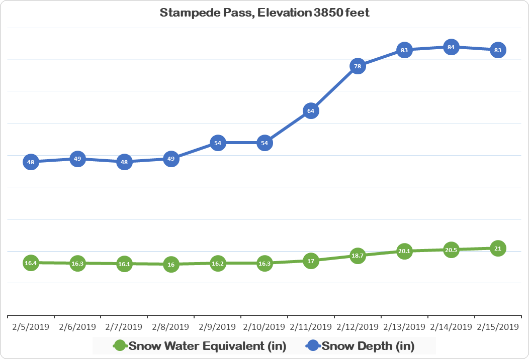
At the Stampede Pass SNOTEL location, southeast of Snoqualmie Pass, snow depth increased 35 inches —while snow water equivalent increased 4.6 inches. In other words, for every 10 inches of snow, there was a gain of about 1.3 inches of water.
For every yin there is a yang
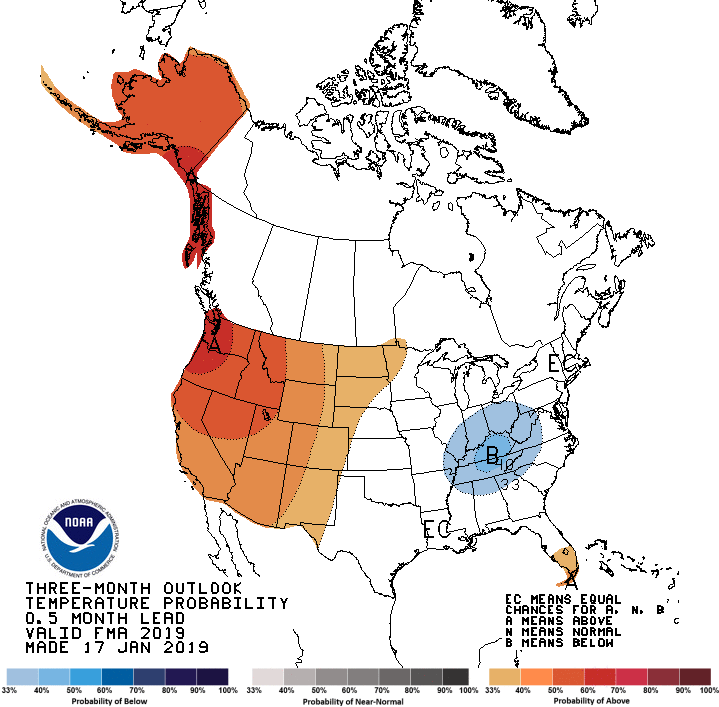
The National Oceanic and Atmospheric Administration’s Climate Prediction Center (CPC) is predicting that March temperatures have an equal chance of being above normal, below normal or normal. But for the three-month period of March – May, the CPC forecasts higher odds for above normal temperatures.


