Official websites use .gov A
.gov website belongs to an official government
organization in the United States.
Secure .gov websites use HTTPS A
lock (
) or https:// means you’ve safely connected to
the .gov website. Share sensitive information only on official,
secure websites.
Cleaning up: An update to the Landsburg Mine site cleanup plan
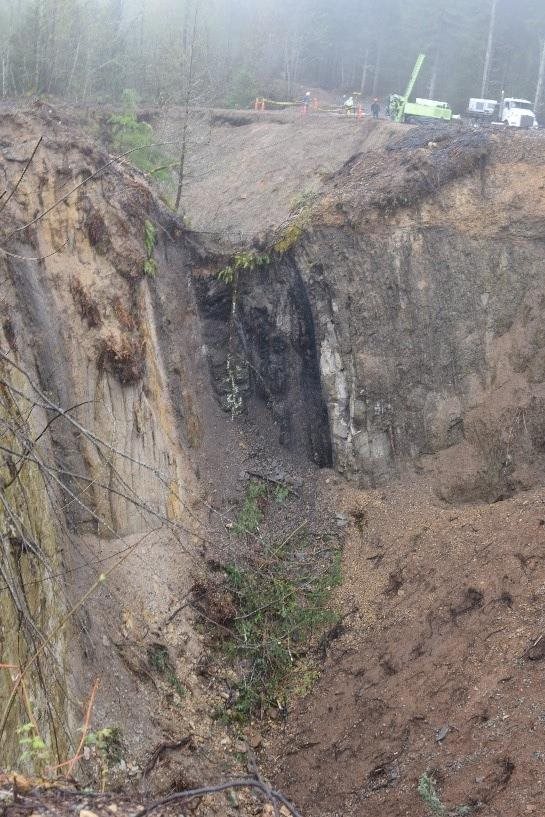
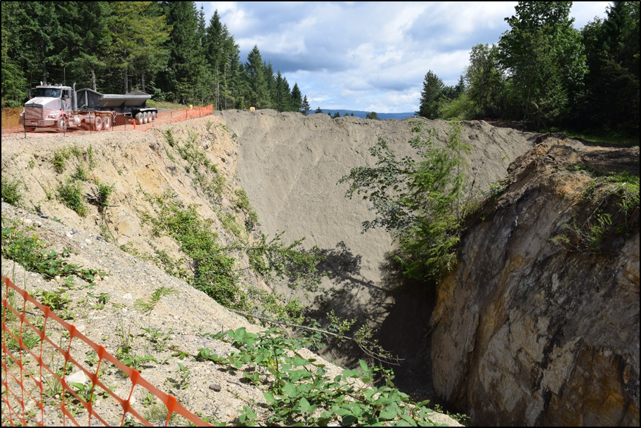
A large trench that formed after coal was mined underground has been filled and capped. Waste materials were dumped into part of the trench. The cap keeps rain and snow away from the dump area to protect groundwater.
Facing north as crews prepare to fill the "subsidence trench" formed by collapsed underground mine tunnels, an intact coal seam is exposed.
The Landsburg coal mine operated for many years under a hill in Southeast King County. The mining method changed the landscape by creating a depression, called a subsidence trench, that follows the path of the mine’s tunnel line. Several companies then used part of the trench to dispose of industrial waste in the 1960s and 1970s. The mine closed in 1975.
We’re proposing changes to a cleanup plan we adopted in 2017 for the former mine site. You’re invited to review and comment on an amendment to a legal agreement, called a consent decree (CD), under which we oversee cleanup, and an amendment to the cleanup action plan (CAP) itself. The changes will allow us to respond to developments that unfolded after we approved the cleanup plan.
We also welcome you to an online public meeting, May 19, 2021 at 6 p.m. We’ll explain the new developments, how the amendments address them, answer questions, and allow time for anyone who wants to make oral comments.
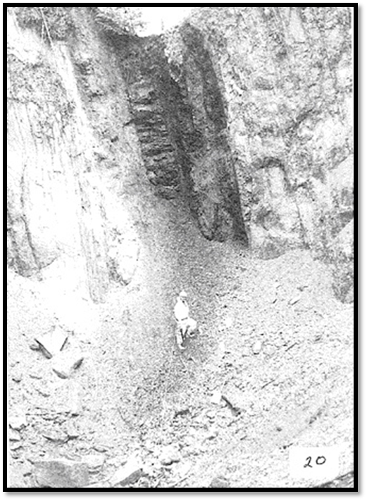
Another view of a coal seam exposed in the subsidence trench, seen during the 1991 Site Hazard Assessment. A worker in a hazmat suit stands at the base of the outcrop.
A closed coal mine that was used for waste disposal
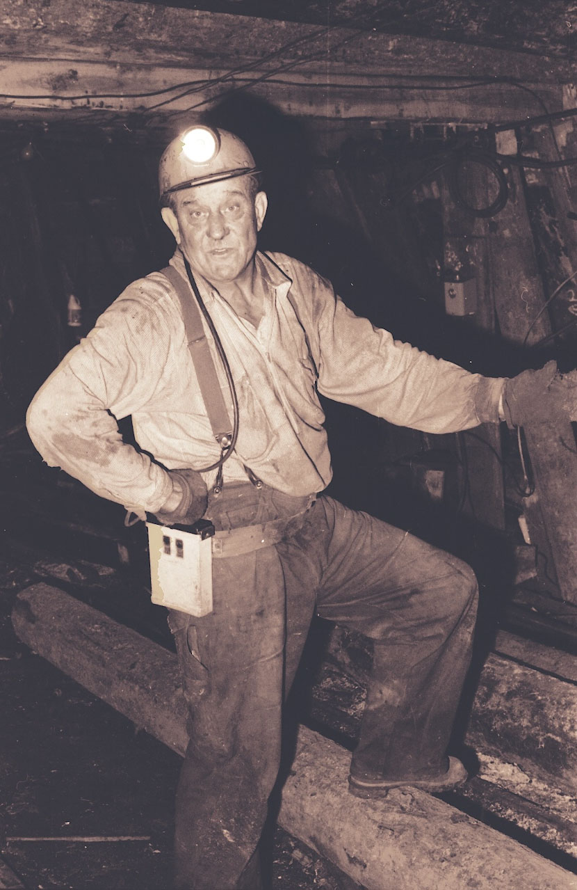
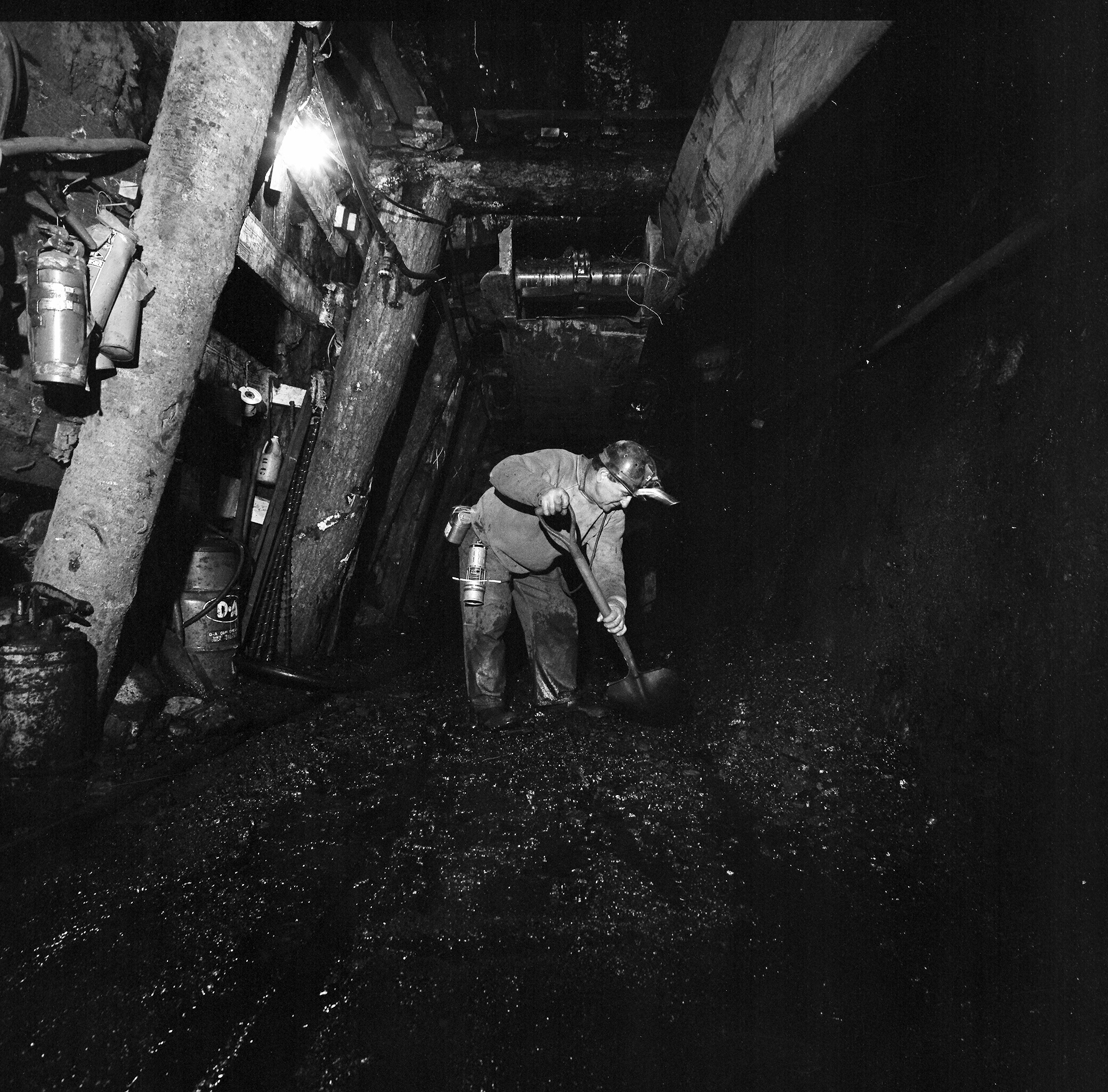
Miners tunneled into veins of coal near Ravensdale in Eastern King County. Photo courtesy Palmer Coking Coal.
The Landsburg Mine site is a former underground coal mine located approximately 1.5 miles northwest of Ravensdale in Southeast King County. Coal was mined there for many years by tunneling along a northeast-southwest coal seam in a hill.
During the late 1960s to late 1970s, industrial wastes were disposed in the northern portion of a subsidence trench that formed above the former mine.
Investigations since then, mainly a 1996 remedial investigation, did not indicate that there was any contamination to groundwater coming from the wastes. Ongoing groundwater monitoring from 1996 until the 2017 cleanup plan was approved also did not detect any contamination, indicating that no contamination is coming off the site and into surrounding areas.
Legal agreement and plan to clean up Landsburg Mine
We finalized the CD in November 2017 with the five companies — called the PLP group — that are responsible for the cleanup of the mine site. The CD contained a CAP that included backfilling and capping the trench wastes, and monitoring groundwater. It also included planning for a Contingent Groundwater Extraction and Treatment System (CGETS) — commonly referred to as “pump and treat” — to prevent contamination from leaving the site should any contamination be detected coming out of the former mine in the future.
This approach is commonly used at many sites to clean up contaminated groundwater and prevent it from spreading to the surrounding environment.
The trench formed from the collapsed Landsburg Mine tunnel, shown with a solid red line in this map of the site.
1,4-Dioxane detections outside of former mine
In response to public comments received on the draft CAP, Ecology added the compound 1,4-Dioxane to the list of contaminants that would be monitored in groundwater samples. 1,4-Dioxane is an emerging contaminant and was not historically investigated at solvent-release sites. It was added to the list of contaminants out of consideration of public comments.
The PLP Group has monitored groundwater for 1,4-Dioxane since 2017 as part of the CAP. Data from 2017 to 2020 showed “hits” of 1,4-Dioxane in trace amounts at three of the 17 site wells. The three wells where trace 1,4-Dioxane was detected are all located in the north portal area. It was not detected in any other wells, or in surface water at the north portal.
Investigations and monitoring indicate that these trace detections of 1,4-Dioxane are isolated and the low levels found will have no impacts to the Cedar River, nearby private wells, or the City of Kent’s Clark Springs Water Supply wellfield. No other contaminants were detected in these wells or other site wells, which is a good sign that wastes are not migrating from the mine.
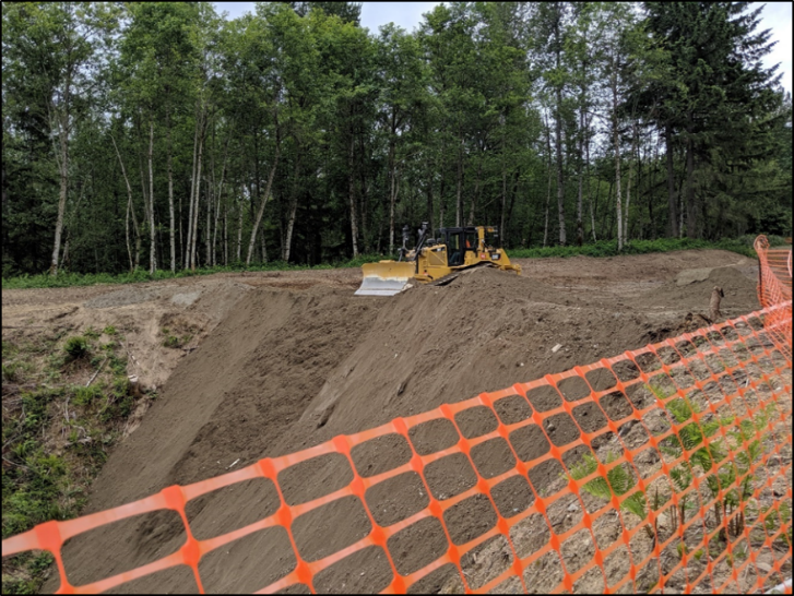
Building the cap, 2019: A bulldozer pushes clean soil into the former mine's subsidence trench.
What is the status of the cleanup and what happens next?
Trench wastes have been covered
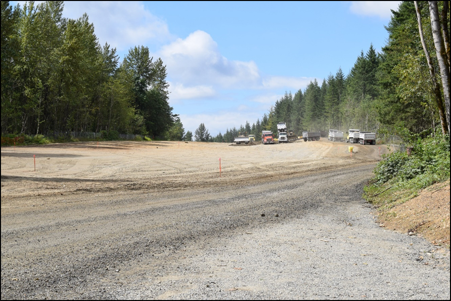
Cleanup construction began November 5, 2018. The trench area where the wastes were disposed has been filled with clean backfill, then covered with an impermeable geomembrane liner to prevent further infiltration of rainwater or melted snow. A stormwater conveyance system and infiltration pond was constructed to handle stormwater flow at the capped areas. Two feet of soil were placed on top of the cap to protect the geomembrane and the soil was seeded with grass to prevent soil erosion. The trench capping and stormwater system work was finished on November 9, 2020.
What are the benefits of covering the wastes?
The industrial wastes disposed in the trench are no longer exposed within the trench. By infilling the trench with clean soil and covering it with an impermeable cap, people and animals are prevented from coming in contact with the wastes.
The geomembrane used for the cap greatly reduces water that can infiltrate through the waste disposal area and potentially leach hazardous chemicals from the wastes.
By nearly eliminating all infiltration of surface water to groundwater in the northern part of the trench, the cap may enhance a northward direction of groundwater flow beneath the waste area, away from the Rock Creek watershed where the Clark Springs Water Supply is located.
Another view of trench infilling, looking north, 2019. 148,016 cubic yards of fill material was placed to build a cap over the subsidence trench .
Is the Clark Springs Water Supply in Rock Creek at risk from the site?
Investigations indicate that there is no risk to the Clark Springs Water supply due to the location of the wastes further away and in a different watershed.
Groundwater within the mine and beneath the waste area naturally flows northward toward the Cedar River Watershed. At the south end, groundwater flows to the south toward Rock Creek. There are no wastes in the subsidence trench at the south part of the site. This means only clean water goes into the mine interior and comes out of the southern end of the former mine. The cap will lessen water coming in at the northern end where the wastes are located, while allowing water in at the southern end. This may enhance the northward flow of water beneath the mine wastes, further ensuring that only clean groundwater at the south end goes into the Rock Creek watershed.
An improved response to the 1,4-dioxane detections
Under the existing CD and CAP, if a contaminant was discovered in groundwater coming out of the former mine above a trigger amount, the PLP group would be required to implement the pump and treat system. However, the 1,4-Dioxane detected at the site did not raise the kinds of concerns that the contingent pump and treat system was intended to address because it was found at low levels in isolated spots only in the north end of the site. The 1,4-Dioxane detected does not pose a threat to the Cedar River or nearby private wells. More efficient actions to ensure the safety of human health and the environment are planned under the amendments to the CD and CAP.
The cap over the Landsburrg Mine cleanup site neared completion in July 2019, as dirt filled the trench formed by collapsed tunnels beneath.
We’ve reviewed a technical evaluation (referred to as a “White Paper”) prepared by the PLP Group, and agreed with its finding that using the pump and treat system would have significant environmental impacts and financial costs, and would not lower the limited risk posed by 1,4-Dioxane much, if at all. We also agreed that the CD and CAP should be amended to address only 1,4-Dioxane at the northern end of the site. It would not change the existing requirement to implement the pump and treat system for all contaminants if detected in groundwater monitoring wells in the rest of the site, including 1,4-Dioxane, should mine waste contaminants potentially start emerging from the mine.
Another historic view from a Landsburg Mine tunnel. Photo courtesy Palmer Coking Coal.
The CAP amendments will require the PLP Group to:
Upgrade the cover over the buried waste with a more watertight cover system, and a surface water management system to control stormwater on the site (already completed);
Add routine monitoring of the three off-site groundwater monitoring wells north of the site where 1,4-Dioxane was discovered;
Continue increased quarterly groundwater monitoring frequency of the affected northern area wells;
Install a discharge pipeline to the Soos Creek sewer line for treatment at the King County South Plant wastewater treatment facility, which will help to respond more rapidly if conditions at the site change and groundwater impacts are found;
Evaluate the potential of using bioremediation, a process that uses natural bacteria in groundwater to consume 1,4-Dioxane.
We believe that the CD/CAP amendment will appropriately address 1,4-Dioxane, given its low concentrations and isolated location. We will however retain authority to require treatment or other measures as needed if conditions change in the future.