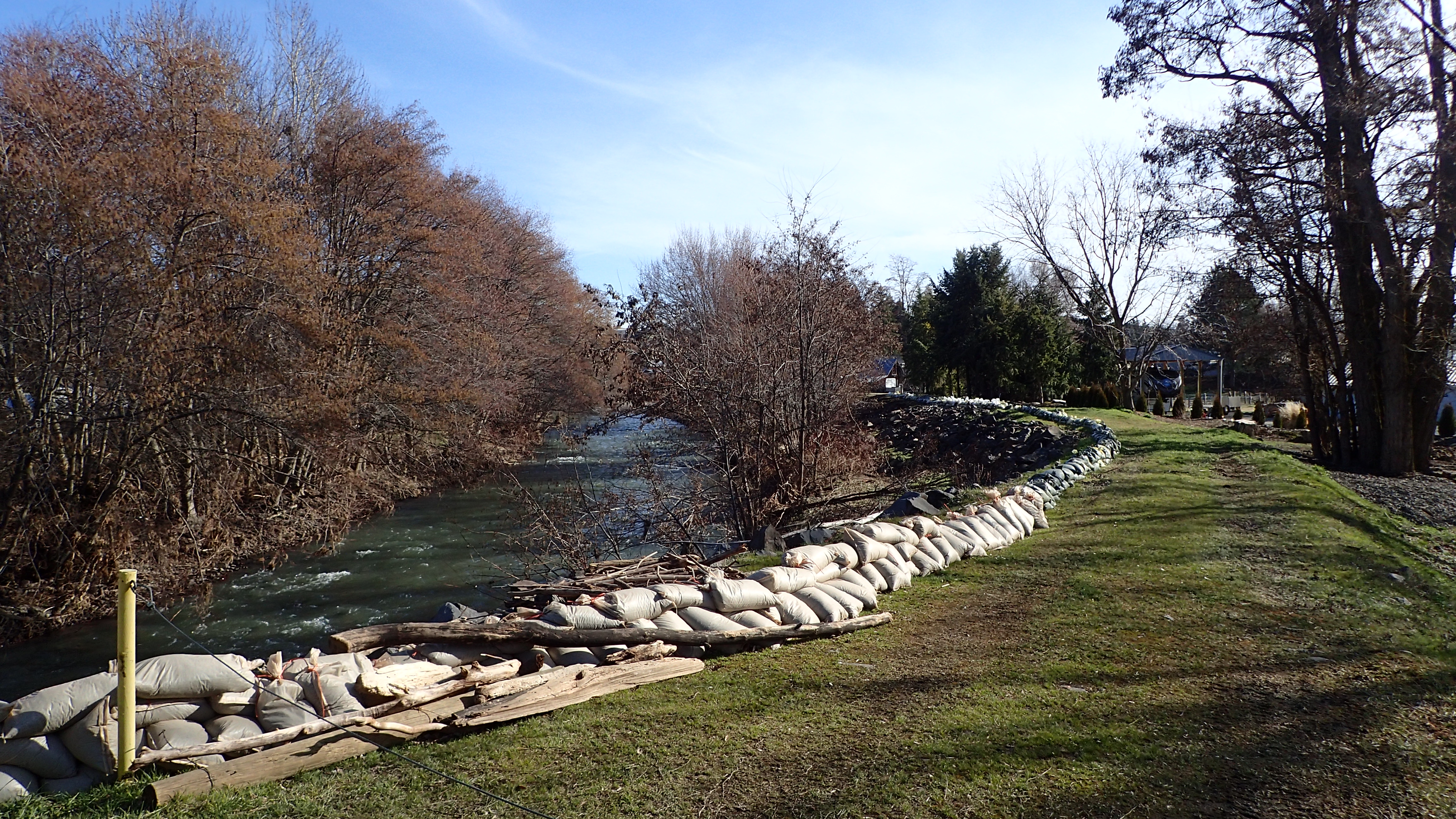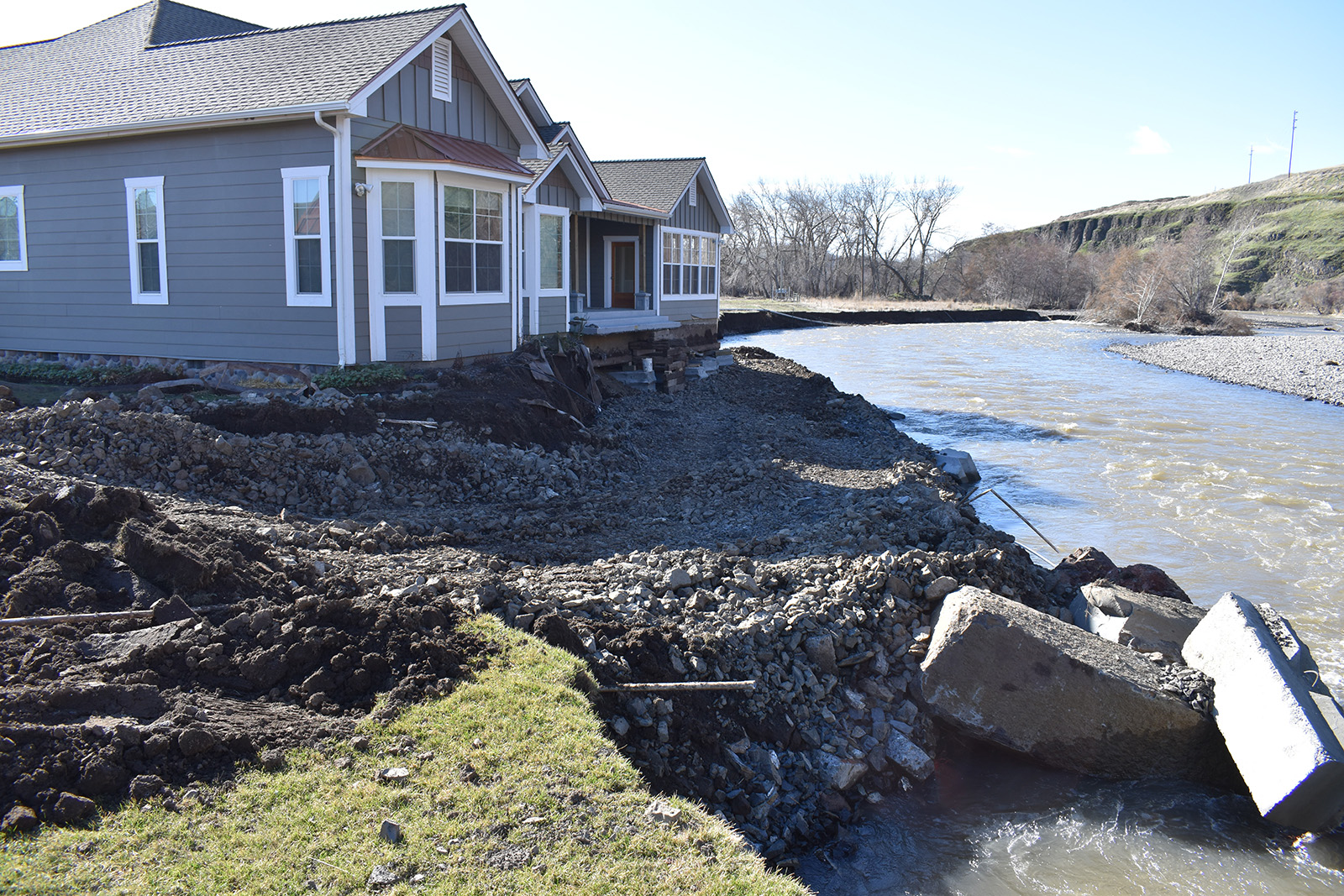
As we transition into cooler and wetter weather this autumn, Washington is on the cusp of another potential flood season. October 7-11 is Flood Awareness Week, and we are raising awareness about flood preparedness, the importance of restoration and protection projects on Washington's coasts and river floodplains, and benefits of flood insurance.
We are working in partnership with the state Office of Insurance Commissioner and Military Department’s Emergency Management Division to share this information with communities across the state.
Flooding is the most common natural disaster
Flooding is Washington's most common and costliest natural disaster. Since 1970, all 39 Washington counties have received a presidential disaster declaration due to flooding. Between 2006 and 2019, the average flood insurance claim payment was $23,500.
Floods put lives and livelihoods at risk. A single catastrophic flood can cost hundreds of millions of dollars due to damages to homes, buildings, and infrastructure, losses to business and agricultural activities, and disruptions to daily activities.
For example, on Dec. 3, 2007, an atmospheric river dumped up to 20 inches of rain in the Willapa Hills in southwest Washington, causing widespread record flash flooding in the Chehalis River basin. Floodwaters inundated parts of Lewis County as well as the cities of Centralia and Chehalis. U.S. Interstate 5—the West Coast’s primary north-south thoroughfare—had to be shut down for several days.
It’s estimated the 2007 Chehalis basin flood cost Washington $930 million to respond and recover.
Causes of flooding
Floods can happen anywhere in our state. In Western Washington, flooding typically results from prolonged winter rains. In Eastern Washington and near the Cascade Mountain range, spring snowmelt and rain-on-snow events are the primary causes of flooding.
Sea level rise, coastal storm surges, overwhelmed storm drains, flash floods, post-wildfire floods and debris flows, ice jams and debris blockages, and channel migration are also potential sources for flood-related damage.

Floodplains and humans
About 2 million people in Washington live in areas susceptible to flooding. By 2025 that number could increase to up to 2.6 million people, with nearly half considered to be vulnerable and at higher risk for poor health outcomes due to adverse socioeconomic factors.
Since the dawn of human history, people have been drawn to floodplains. As rivers flow and meander, eroding the earth around them, they create wide, flat fertile valleys desirable for agriculture. Floodplains also offer plentiful freshwater habitat for fish and wildlife, and important hubs for water-borne transportation.
As settlers of European origin developed the Pacific Northwest, they placed more permanent structures and critical infrastructure in floodplains because that is where the people were. Currently, the estimated value of all structures in state’s flood hazard areas is more than $86 billion.
Changing how floodplains are managed
Historically, managing Washington’s flood hazards focused on containing stream flows within river channels and rapidly clearing floodwaters. Large flood control dams and channel straightening projects disconnected rivers from their natural floodplains. This approach resulted in degraded water quality and habitat, causing salmon populations to decline across the state.
More recently, we have shifted how our state manages flood hazards. We are using a more holistic approach that deploys different strategies that work with natural processes—including floodplain storage and channel migration—to limit flood-related damages while improving water quality and aquatic habitat.
Through our floodplain management program, we’re helping Washington communities manage stream and river floodplains by offering resources to identify flood hazards, plan a more resilient landscape, and complete projects to reduce flood risks to people and property.
We work with Washington communities and Federal Emergency Management Agency to update flood maps for the National Flood Insurance Program to better understand risk, support community flood hazard planning and feasibility studies, and implement projects like floodplain setbacks, home elevations, and projects designed to that reduce flood hazards and restore natural floodplain functions.
We also provide funding to help communities to restore floodplains and reduce flood hazards. Our Flood Control Assistance Account Program assists local jurisdictions with flood hazard management planning, mitigating flood hazards, and emergency flood response and recovery work. Our Floodplains by Design grant program works to accelerate integrated efforts to reduce flood risks and restore habitat along Washington's major river corridors.
Stay tuned this week for more details about how investments in floodplain restoration can result in measurable reductions to flood risk, improved salmon habitat, and provide other economic and social benefits.

