Wildfire risks caused by climate change
Climate change and wildfire
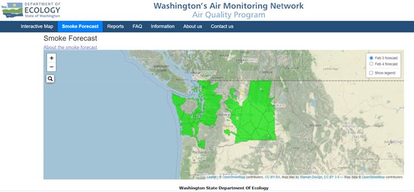
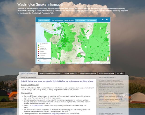
Air & ClimateWe monitor air quality conditions and forecast smoke levels. We also work with the Washington Departments of Natural Resources and Health, the U.S. Forest Service, and the National Weather Service to track wildfire smoke and protect people who live in Washington.
Environmental influences
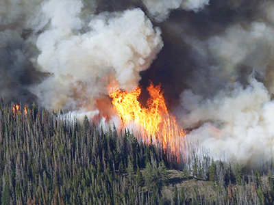
The risk and extent of wildfires in the western United States is growing because of climate change. Snow is melting earlier in the spring, leading to soil and forests that are drier and stay dry longer. This leads to wildfires that can burn hotter and spread faster. Climate change causes forest fuels (the trees and plants that burn and spread wildfire) to be drier and more ready to burn.
The number of large fires has doubled between 1984 and 2015 in the western United States. These hotter, drier conditions also set the stage for more human-ignited wildfires. For much of the west, projections show that an average annual rise in temperature of one degree Celsius may increase the area burned in a typical year by as much as 600 percent.
The effects of climate change that contribute to increased wildfire risk include:
- Earlier snowmelt.
- Rising temperatures which contribute to more prolonged heat waves.
- Drier summers, increased drought, lower soil moisture content.
- Spread of the mountain pine beetle and other insects that kill or weaken trees and plants.
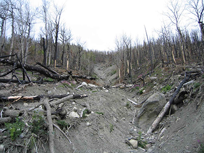
- More fuels from dead trees and plants.
If greenhouse gas emissions continue to rise, we can expect more wildfires, for longer seasons.
Human influences
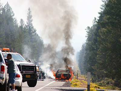
While climate change may not be the only cause of wildfires, the rising temperatures and increased drought from the changing climate contribute to more frequent, more damaging fires. These conditions make it easier for people to start fires. Those fires may spread more rapidly and burn more intensely, making them harder to extinguish. More than 80 percent of U.S. wildfires are started by people whether by accident, negligence, or intent (arson).
The Bureau of Land Management uses the Wildland Fire Management Information (WFMI) system to classify human-caused wildfires.
| General Cause | Specific Cause |
|---|---|
| Campfire | Cooking, warming, bonfire |
| Smoking | Cigarette, cigars, pipes, and matches/lighters used for lighting tobacco |
| Fire use | Debris burning, burning ditches, fields or slash piles, etc. |
| Incendiary | Arson, illegal or unauthorized burning |
| Equipment | Vehicles, aircraft, exhaust, flat tires, dragging chains, brakes, etc. |
| Railroads | Exhaust, brakes, railroad work, etc. |
| Juveniles | Fire play (matches, fireworks, lighters, etc.) |
| Miscellaneous | Burning buildings, fireworks, power lines, shooting (ammo, exploding targets), spontaneous combustion (hay baled while still wet, compost piles, oily rags), blasting, and coal seams |
| Other known or unknown | Cause unknown or noted in the remarks (i.e., exploding target) |
How you can help prevent wildfires
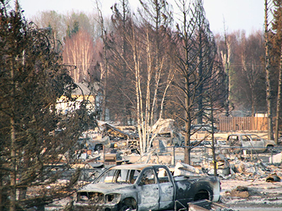
More and more people are making their homes in woodland settings — in or near forests, rural areas, or remote mountain sites. There, homeowners enjoy the beauty of the environment, but face the very real danger of wildfire.
Follow these guidelines to prevent wildfires, protect your property and surrounding areas, and protect your health from smoke.
- Never throw cigarettes out your car window or on the ground.
- Don't park hot vehicles, recreational vehicles, trailers, fuel-powered lawn equipment on grass.
- Don't drag trailer chains on the ground, which could cause sparks.
- Clear pine or fir needles or yard waste from around your house.
- Keep your gutters clean.
- Obey burn bans. Report illegal burning.
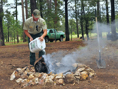
- Put out camp fires completely.
- Monitor air quality in your area.
- Have an evacuation plan in place — whether you're home or traveling.
- Make sure you're wildfire ready with these emergency preparedness tips.
To help slow the effects of climate change that contribute to increased wildfire risk, we are working to reduce greenhouse gases. You can help by reducing your carbon footprint.
We monitor wildfire smoke to protect your health
Because the risk of wildfires is increasing with the changing climate, we, along with our partners, monitor air quality to protect your health. We have monitors around the state and use a few different tools to communicate with you. During a wildfire event, we can add temporary air monitors.