

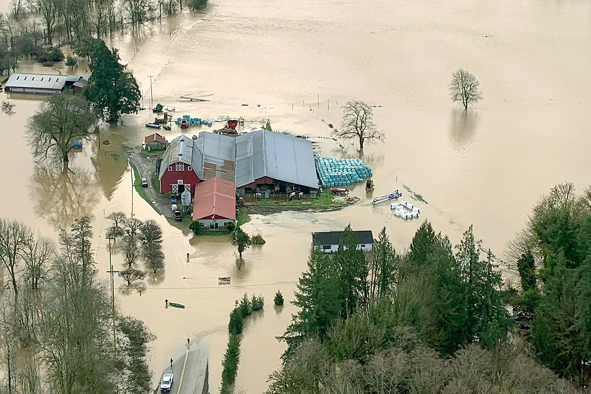
A dairy farm inundated by January floodwaters in the Chehalis River basin.
As communities throughout the Chehalis River basin in Southwest Washington recover from the worst flooding in more than a decade, our Office of Chehalis Basin (OCB) is assessing how some critical flood-damage reduction investments fared during the Jan. 6-9, 2022, event.
Street flooding from China Creek near Centralia College.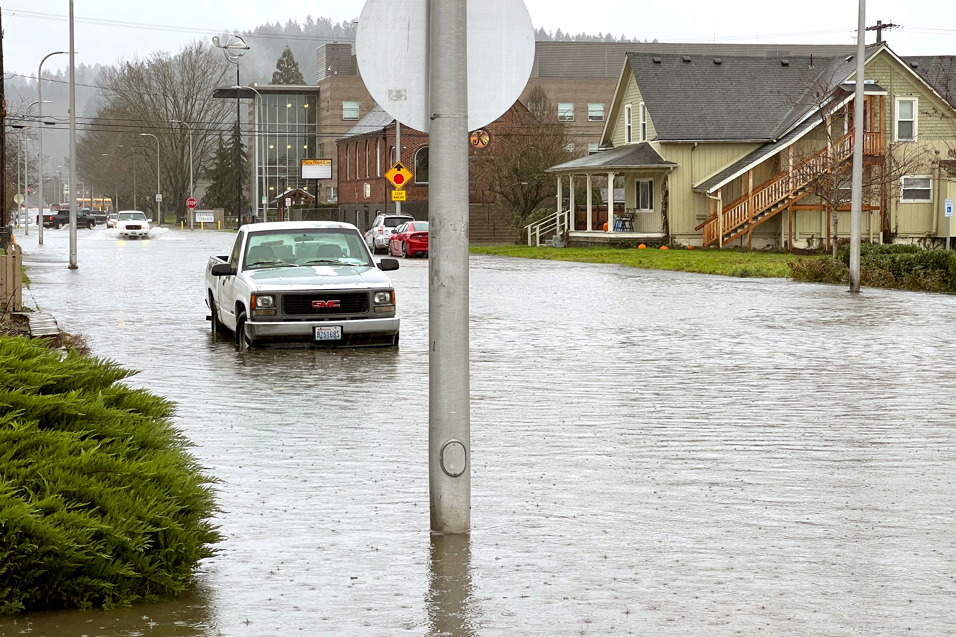
For several hours on Jan. 7, the Washington State Department of Transportation temporarily closed U.S. Interstate 5, the primary thoroughfare connecting Vancouver, British Columbia, Seattle, Portland, Ore. and beyond. Other local highways and roads in Thurston, Lewis, and Grays Harbor counties also closed or saw disruptions due to rising waters. Sadly, two people lost their lives.
“The major flooding we experienced in January adversely affected thousands of people, businesses, farms and properties throughout the Chehalis basin and beyond,” said OCB Director Andrea McNamara Doyle. “It’s important we take stock of the investments we’ve made to reduce flood-related damages across the basin to date and recognize the urgent need for continued progress.”
Teitzel Road inundated by floodwaters from South Hanaford Creek flowing from field to field.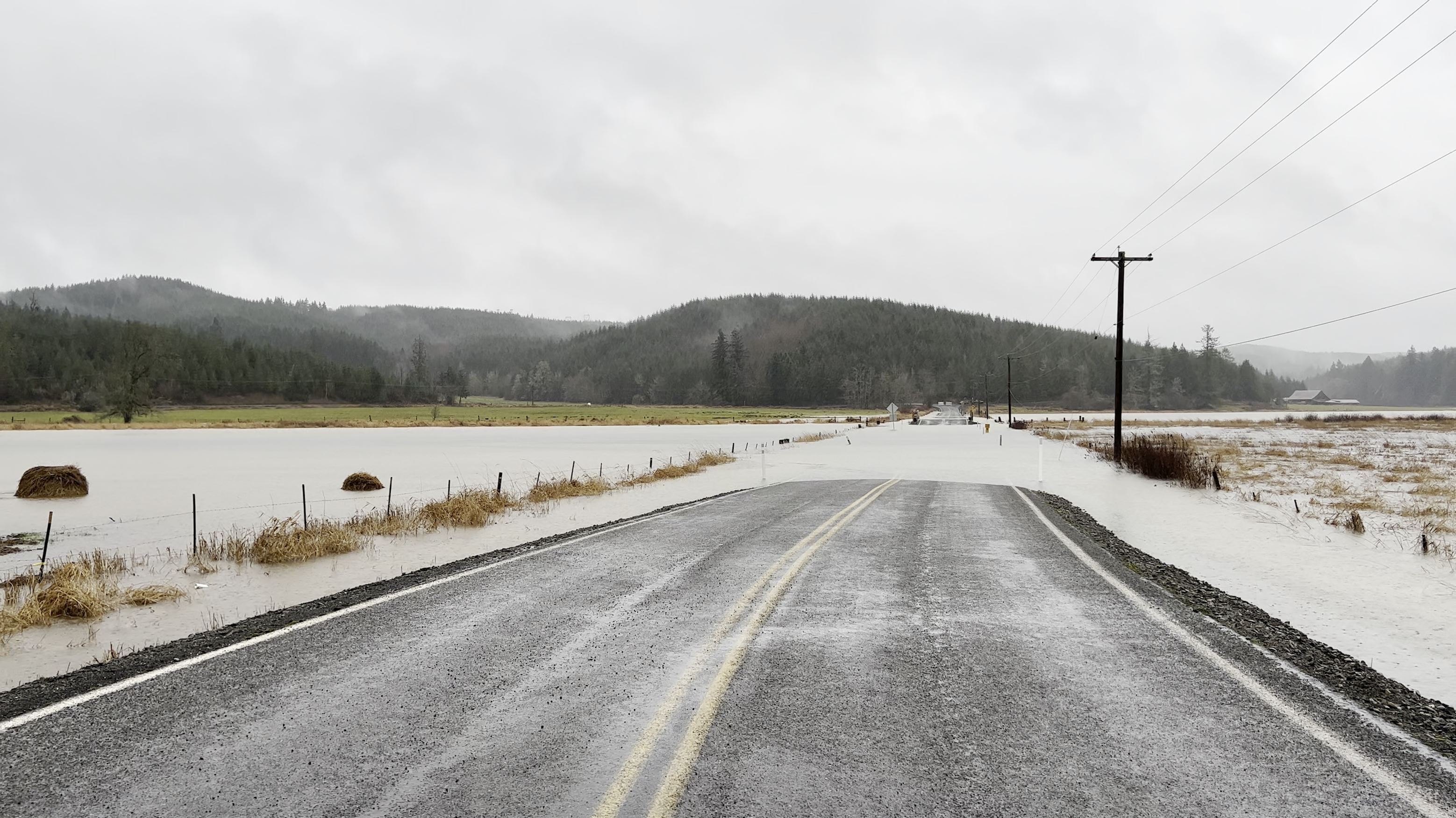
OCB and the independent Chehalis Basin Board (Board) are responsible for putting in place the Chehalis Basin Strategy. This ambitious collection of near- and long-term actions involving small- to large-scale projects is helping reduce damages from major floods while restoring and protecting aquatic species and their habitat.
Since 2017, the Board, OCB, and Chehalis River Basin Flood Authority (Flood Authority) have helped direct more than $48 million in local and state funding for 39 flood-hazard reduction projects including:
- Elevated farm pads and evacuation routes
- New or improved pumping stations
- Localized measures to stabilize stream banks to control sediment and erosion
- Levees and dikes
- Street regrades
- State-of-the-art flood warning system
“The Flood Authority’s flood warning system website was incredibly active during the January flood,” said Dave Curtis, flood warning system expert for the Flood Authority. “We recorded nearly 25,000 individual user visits, and our flood inundation maps received almost 75,000 hits, providing vital information to the community during the flood emergency.”
By comparison, a year ago, the flood warning system recorded between 7,000 and 9,000 individual user visits. The Flood Authority recently launched a survey to ask users what worked during the January flood and what might be improved.
Elevated farm pads
Elevated farm pad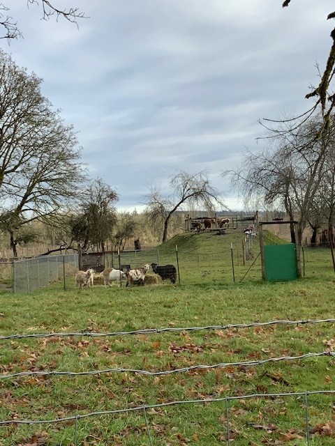
After hundreds of farm animals drowned during record-setting floods in 2007 and 2009, we worked with the Flood Authority to invest $866,000 to construct 22 elevated farm pads in Grays Harbor and Lewis counties. During a flood, farmers use the pads to hold livestock and equipment above the rising water. In January, farmers used their elevated pads in locations where rainfall and floodwaters were the heaviest. There were no reports of drowned livestock in the two counties.
Farmers told the Lewis Conservation District their livelihoods could continue because the farm pads kept their animals and equipment safe. In some cases, farmers shared they wished their pads had been larger so they could have put more animals and equipment up.
Ramer Street pumping station in Hoquiam
Ramer Creek pumping station. Image courtesy City of Hoquiam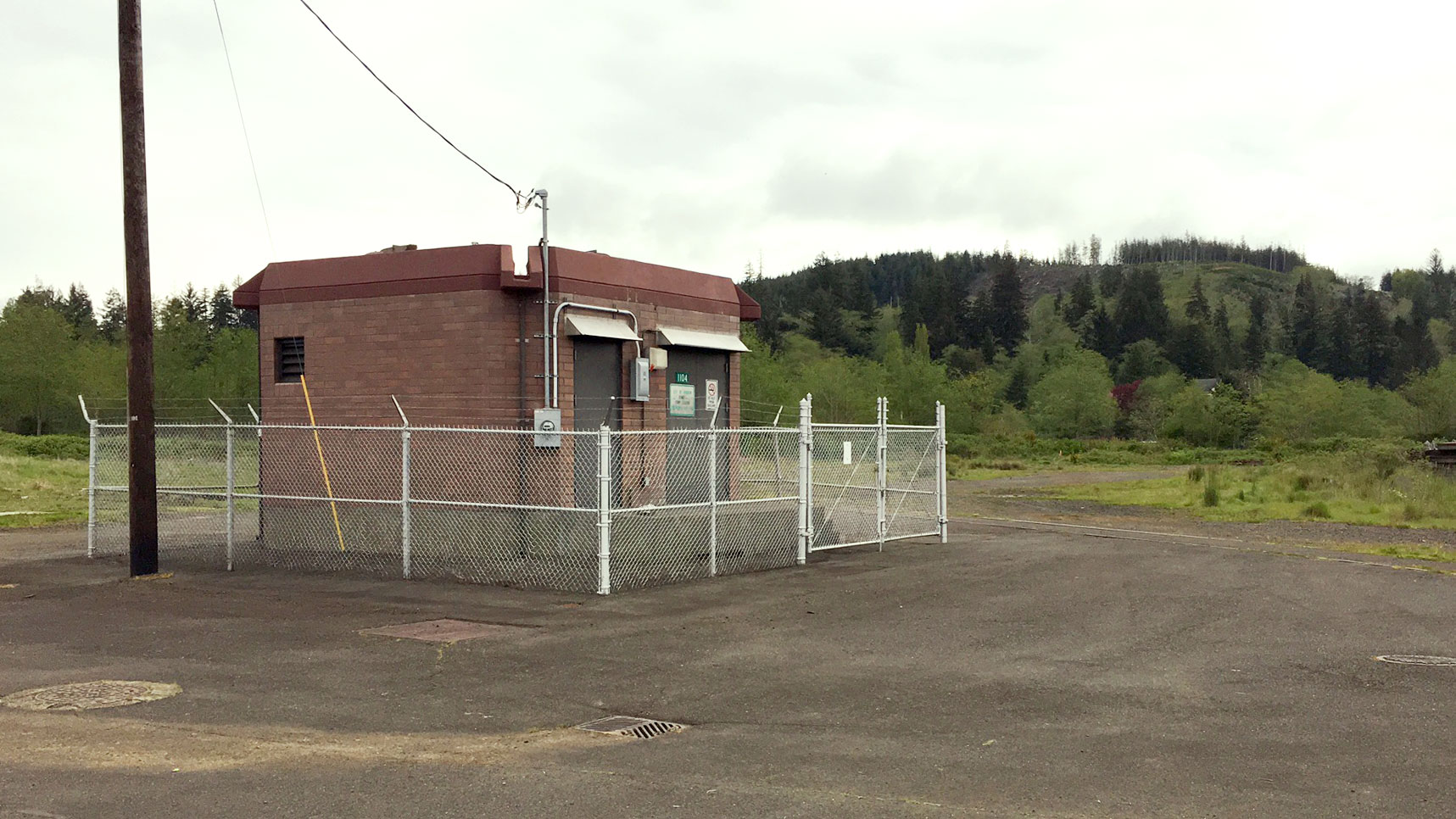
The city of Hoquiam used a $1.3 million grant from the Flood Authority to build a new pumping station to discharge floodwaters to the Ramer Street outfall. Completed in 2018, the project is designed to correct flooding plaguing north Hoquiam residents and businesses for decades due to tidal influence on the Hoquiam River. During the January 2022 flood, the new station worked continuously for 30 hours — pumping an estimated 51 million gallons of water. As a result, the Ramer drainage basin stayed dry.
This was not the case everywhere in the city. To keep more neighborhoods and businesses dry, the Flood Authority and Board are funding design and permitting for rebuilding three additional pumping stations in Hoquiam and Aberdeen that are approaching the end of their useful life. Collectively, these stations protect properties currently assessed at over $100 million.
“For some locations, pumps seem to be the right solution,” McNamara Doyle said.
Chehalis-Centralia Airport pump station
The levee and pump system for the airport keeping floodwaters from the Chehalis River at bay. Image courtesy Washington State Patrol.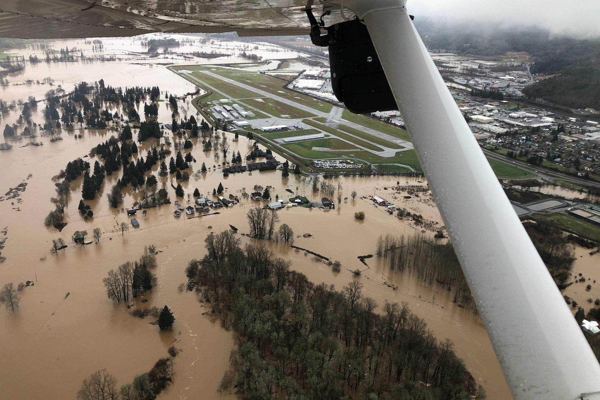
The Board, Flood Authority, and OCB invested $1.14 million to design and construct a new airport pump system at the Chehalis-Centralia Airport capable of removing excess water from behind the existing levees The new system, completed in 2018, helps ensure the airport can operate during a flood or be quickly restored after an event.
Built to protect the airstrip, privately owned recreational aircraft and businesses located behind the levee, the new station pumped 518 million gallons of water during the January flood. Airport operations coordinator Brandon Rakes said the pumping station helped protect $45 million worth of public infrastructure and private assets while keeping more than 1,000 jobs from interruption.
Aircraft remain protected behind the airport levee while homes on the other side are flooded by the Chehalis River.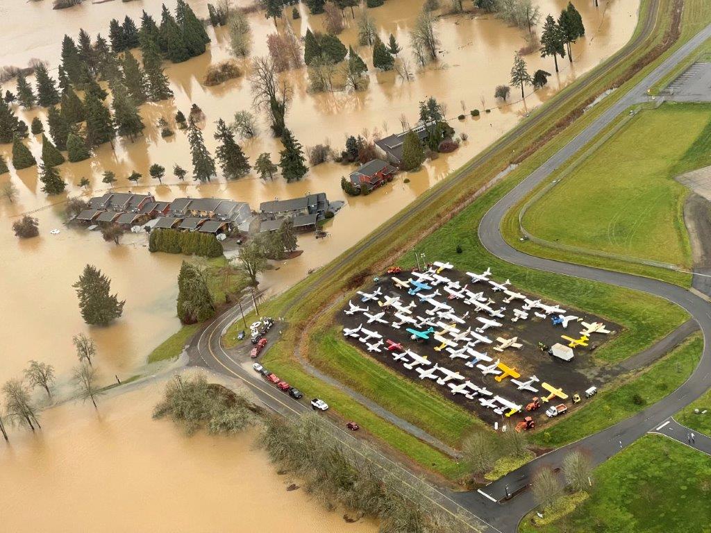
“It is an old saying but it is true, ‘An ounce of prevention is worth a pound of cure,’" Rakes said. “The investment is incredibly valuable to our community because it saves people from additional loss and hardship related to flooding. While the project cost a little over $1 million, the millions of dollars of infrastructure and jobs it helps protect are easily worth many times that amount.”
Pilot erosion management project in Grays Harbor County
In November 2021, the Flood Authority and OCB invested $182,000 for an emergency pilot project to manage erosion along Cloquallum Creek in Grays Harbor County. The project’s first phase, designed, permitted, and constructed in 10 weeks, was designed to prevent the creek from migrating and undercutting a home and septic drain field. Emergency stabilization measures incorporated root wads in and among rock armoring to protect against further erosion and improve aquatic habitat in the creek. Further work to restore and enhance the site will occur later this year as a second phase.
During the flood, Flood Authority staff Scott Boettcher said the erosion management project kept the creek away from the home and drain field. “The project did great,” he said.
Montesano wastewater treatment plant
Engineered log jacks slow floodwaters next to the Montesano water treatment plant.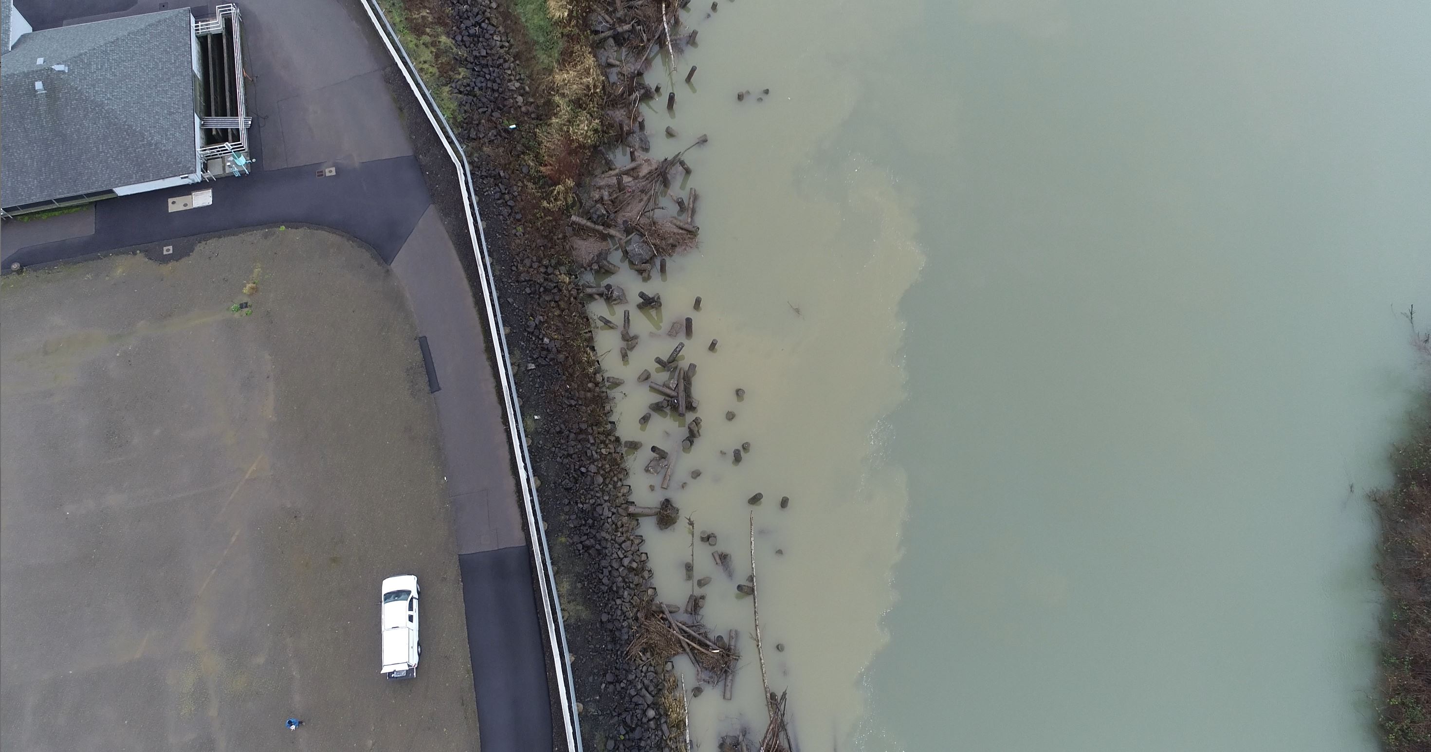
The city of Montesano’s wastewater treatment plant is located along the banks of the Wynoochee River in Grays Harbor County. The riverbank had been eroding at the rate of 17 feet per year, threatening to breach the plant and potentially send millions of gallons of raw sewage down the Wynoochee to the Chehalis River and Grays Harbor.
The Board and OCB invested $4.7 million to among other things stabilize the river around the plant by permanently placing hundreds of log jacks in front of the wastewater treatment plant.
“We were able to breathe a sigh of relief,” Boettcher said. “The plant fared very well during the flood. Nothing washed away.”
Community Flood Resilience and Assistance program
Floodwaters from China Creek creep toward manufactured homes in Centralia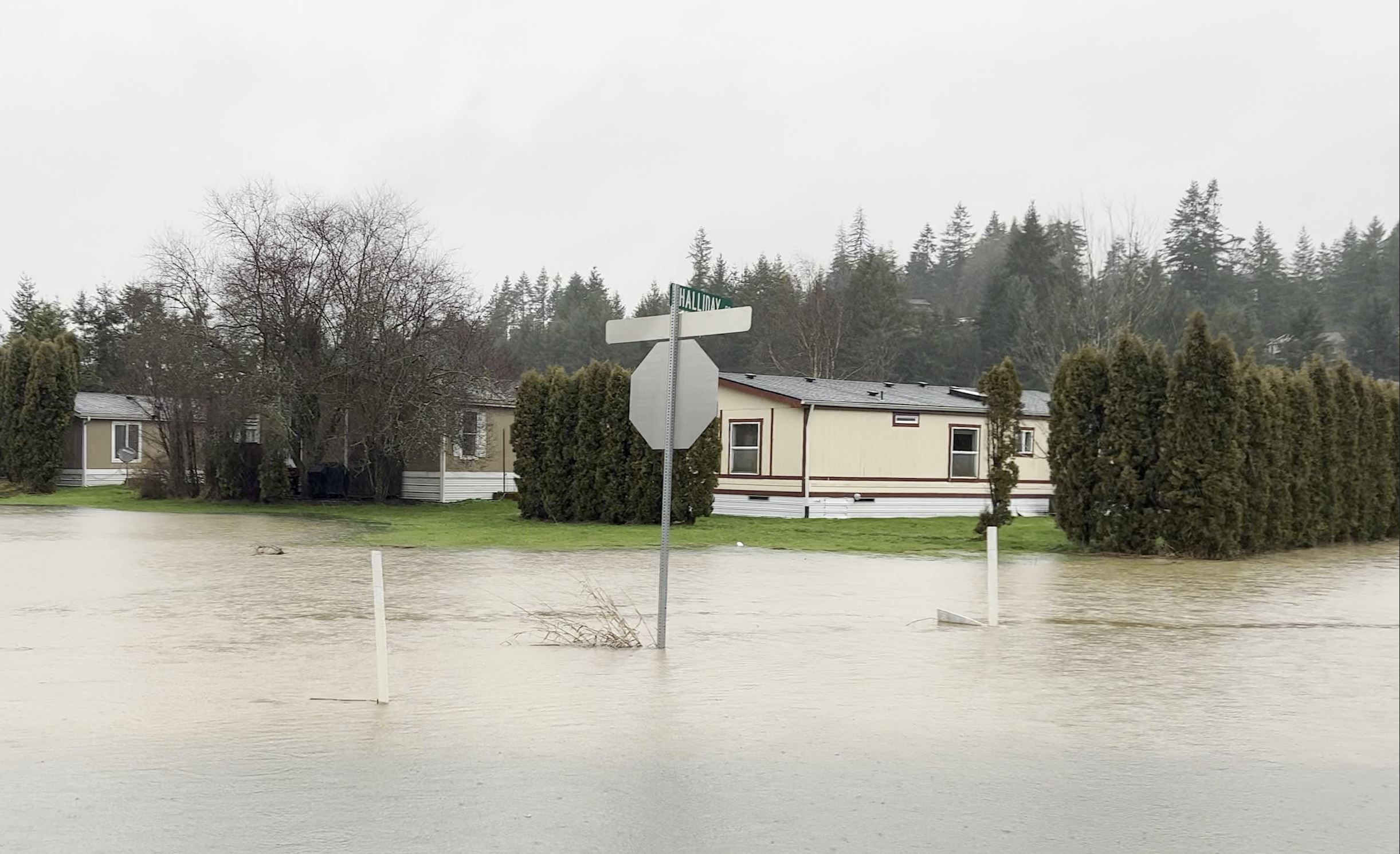
OCB launched the Community Flood Resilience and Assistance (CFAR) program to help fund small-scale projects in the basin focused on reducing future flood related damage to individual homes, businesses, and community assets. We received five new technical and financial assistance requests from basin residents that experienced January flooding in or around their homes.
OCB reached out to 15 other property owners for whom we had recently conducted site visits to see how their properties fared in the floods. While some property owners had floodwaters in their garages and under their homes, only one Aberdeen resident experienced flooding inside their residence. In addition, of 11 homeowners in the town of Bucoda who had flood vents installed or corrected in 2017, none sustained any flood damage during the January floods.
Assisting the January flood response
Washington Conservation Corps members pause for a picture while helping citizens at a sandbagging station.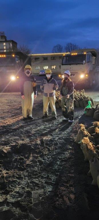
Besides investing in local and state flood-damage reduction projects, Ecology also provided direct assistance to Centralia and Thurston County during the January flood emergency. While waters were rising, our local partners requested assistance from our Washington Conservation Corps (WCC).
At the height of the flooding, we deployed a six-member WCC crew to Thurston County and dispatched another 10 WCC members to Centralia with the Washington National Guard. At both locations, WCC members filled and stacked sandbags to help home and property owners keep floodwaters from inundating residences and businesses.
We also provided flood hazard emergency grants to Centralia and Thurston County. To prepare for future floods and protect the health and safety of city residents, Centralia will use a $13,600 grant to purchase pumps, additional barricades and road signage. Thurston County will use a $54,400 grant to pay for emergency equipment and supplies, staff time, emergency notification costs, and flood debris cleanup.
Background
Due to its wide, flat topography, flooding has always been present in the basin. However, peak flood levels have been rising — with six of the largest historical floods occurring during the past 30 years. As the climate changes, the frequency and magnitude of 100-year floods in the basin is projected to increase.
Besides the 125 mile-long Chehalis River which flows into the Grays Harbor estuary on the Pacific Ocean coast, the 2,700 square mile basin also includes the Black, Elk, Hoquiam, Humptulips, Johns, Newaukum, Satsop, Skookumchuck, Wishkah, and Wynoochee rivers, and their tributary streams.