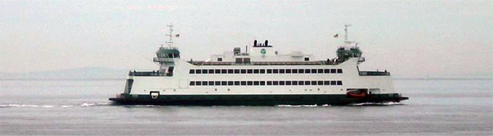
To improve our understanding of Puget Sound and our ability to keep it healthy, state marine scientists have collaborated to install a high-tech water monitoring sensor on the hull of the 64-car ferry Salish that makes daily crossings between Port Townsend and Coupeville.
“Monitoring Puget Sound is important because it helps us understand long-term trends and changes over time,” said Carol Maloy, marine scientist. “Monitoring helps us separate if changes are natural or human-caused. If changes are human caused, perhaps there are steps we can take to reverse the problems.”
The ferry sensor measures how fast the water, from surface to sea floor, is moving. It also measures the direction the water is moving.
This poster is hung inside the ferry for passengers to read.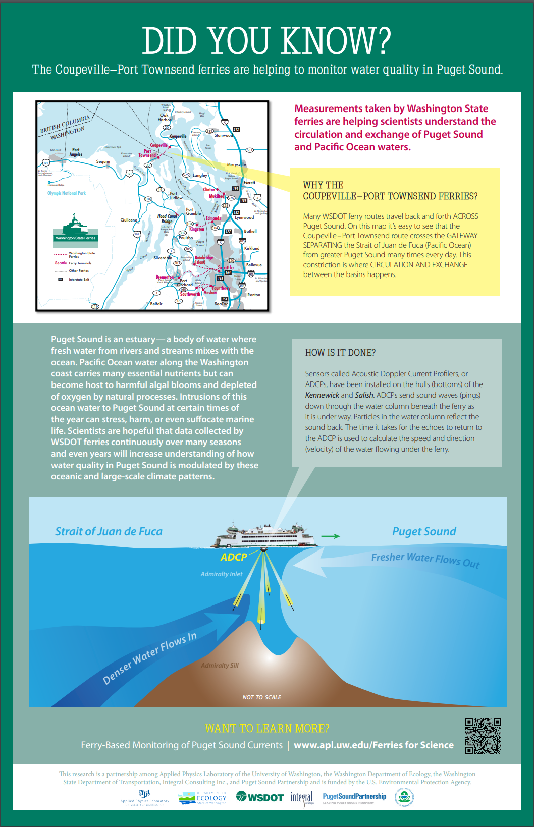
The water velocity information will help scientists understand how much Puget Sound is influenced by the ocean. In particular, they hope it gives them a handle on how much low-oxygen water and corrosive water with very low pH may be coming into Puget Sound from the ocean.
Low-oxygen water is a problem because aquatic life needs oxygen to thrive. Aquatic life can also be sensitive to low pH. The information will also help scientists understand nutrients and algae blooms. This testing will increase understanding about the transport of toxic chemicals and ocean acidification.
Creative and cost effective
“This is a great example of a creative and cost-effective collaboration that will help us better understand the complex marine ecosystem of Puget Sound,” said Ken Dzinbal of the Puget Sound Partnership.
Jim Thomson, principal oceanographer at the University of Washington Applied Physics Laboratory, added, “The Port Townsend-Coupeville ferry makes multiple runs per day, so this gives us unprecedented, continuous monitoring data that we’ve never had before.
How do the sensors work?
The Acoustic Doppler Current Profiler as it looks installed in the hull of the Washington State Ferry "Salish."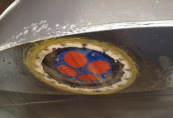
Particles in the water column reflect the sound back. The time it takes for the echoes to return to the ADCP is used to calculate the distance beneath the ship, and the Doppler shift of the ping is used to calculate speed and direction (velocity) of the water flowing under the ferry.
Innovation began in 2009 with Clipper Navigation, Inc.
The state’s innovation began in 2009, when we gained permission to install oceanographic sensors on the private passenger ferry Victoria Clipper IV that transits between Seattle and Victoria.
The sensors measure phytoplankton concentrations, turbidity, freshwater influence, salinity, and water temperatures during the ferry's twice-daily runs.
Now in the program’s fifth year, the Victoria Clipper monitoring program is helping us better understand algae blooms, plankton food web interactions, river plumes, and changes over time in Puget Sound. “We thank the operators of the Victoria Clipper for generously working with us — it’s been a great partnership that continues,” Maloy said.
Funding for the project came from the EPA’s National Estuary Program, which identifies, restores, and protects significant estuaries of the United States, including Puget Sound. Projects are focused on taking action to protect Puget Sound.
Project partners include the Washington Department of Ecology, the University of Washington Applied Physics Laboratory, Clipper Navigation, Inc., Washington State Ferries, the Puget Sound Partnership, the U.S. Environmental Protection Agency (EPA), and Integral Consulting, Inc.
View a video about the Washington State Ferries sensor and a poster of how the science works at UW's Applied Physics Laboratory.
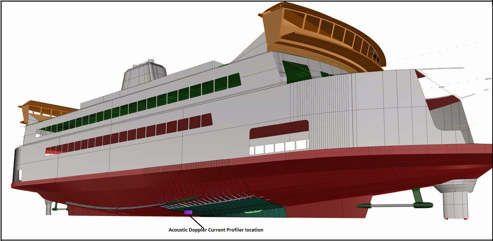
Location on ferry of the Acoustic Doppler Current Profiler