

It’s official. Spring is here. Snow should soon melt. March and April were characterized by unusually cold and dry weather. For water supply, the last two months have presented us with a good news/bad news situation.
The good news
Statewide, Washington is at 118 percent of normal snowpack. This photo, taken by National Parks Service webcam, shows Hurricane Ridge at Olympic National Park on April 27, 2023.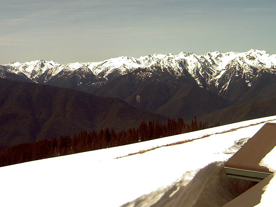
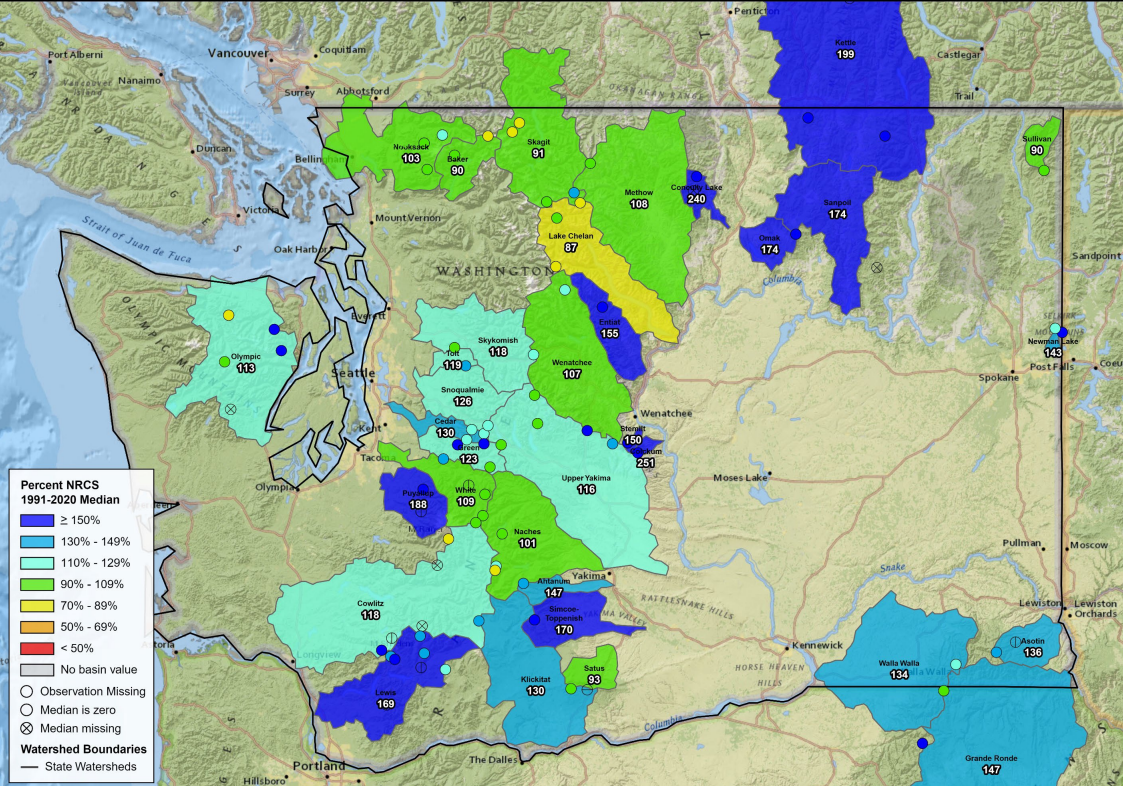
The water year so far, which began in October, has been colder than normal. In fact, October through March was the 53rd coldest first half of a water year on record. so far, April has also seen below-normal temperatures with a rise in precipitation. Despite March’s unseasonable dryness, all of this cold means mountain snowpack hasn’t started melting yet and we should end the month with more snowpack than we started with. Right now, statewide snowpack is at 118% of normal with individual watersheds ranging from 87% in the Lake Chelan watershed to 188% in the Puyallup watershed.
On April 1, the volume of snow storage represented by snowpack in and near Washington amounted to more than 40 million acre feet. To put that into perspective, the city of Seattle and its customers use about 150,000 acre feet a year.
The bad news
This map, taken from the National Integrated Drought Information System, shows precipitation over the last seven days statewide. Yellow areas have had less than a half inch of precipitiation. 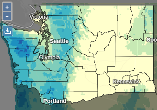
It’s been abnormally dry. Statewide precipitation was 86% of normal. Some basins, including the Upper Skagit, Methow, and Baker are in the 70 percentile. Because we are moving from wetter to drier months, it’s very unlikely that we'll see a make up for the precipitation deficit before the end of the water year (September 30).
Up until recently, cooler temperatures have been doing a nice job of keeping the snowpack up high. That is all about to change as that weird round thing reappears in our skies.
When the snow melts, there’s still the soil moisture deficit to contend with. The state’s soil in many areas is still recovering from previous dry spells. Hydrologists will tell you that soil gets first dibs on melting snow. Once the soil has saturated, it will start sharing that melt with rivers and streams. Soil moisture is currently low on the eastern edge of the state and in the Cascade Mountains. Impacted watersheds include Okanogan, Methow, Chelan, Kittitas, Upper Skagit, Baker, and Pend Oreille.
Going forward, May through July are expected be warmer than normal, but not as bad as the 2014 heatwave that preceded the state’s historic 2015 drought. Summer is projected to have near-normal precipitation and above normal temperatures.
We’re also expecting to end April with a dry spell that will impact streamflows in rain-dominant watersheds. Watersheds most likely to feel the impacts of the predicted dryness include Entiat, Little Spokane, and Nooksack.
Online resources
Image from the National Integrated Drought Information System website. 
Keep up with current water supply information by visiting our statewide conditions page and our water supply monitoring page. The National Integrated Drought Information System recently launched new state-specific drought pages. The folks at NDIS worked with our staff to include some language describing how Washington defines drought.