

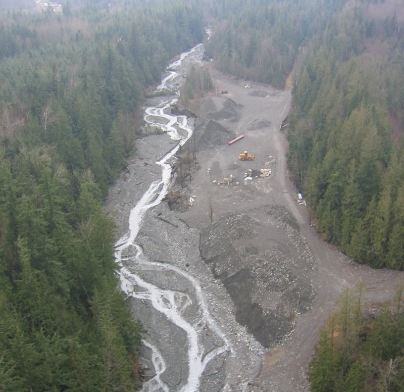
Aerial view of Swift Creek downstream from Sumas Mountain landslide
The west side of Sumas Mountain and the creek that flows from it are about to look a little different.
We're collaborating with the Whatcom County Public Works Department on the Swift Creek Project east of Everson.
Later this year, the county will begin construction of the Swift Creek Action Plan. They have made significant design progress since the end of 2019 when we finalized the plan.
Why are we doing this?
Mother Nature has thrown a “curve ball” to this corner of Whatcom County. A large, slow-moving landslide on Sumas Mountain steadily deposits naturally-occurring asbestos and metals into the creek bed sediment from headwaters on the mountain.
See our previous blog “What do you do when the polluter is a mountain?”
We cannot stop the landslide that’s causing flooding. Our county partner estimates the landslide adds a mass of sediment the size of the Whatcom County Courthouse into the creek each year!
We cannot change the fact that this sediment contains asbestos. Nor can we change its harmful effects when breathed in as dust when exposed sediment dries in the summer.
Check out our health reminder mailer from last summer for more information.
What's the plan?
Swift Creek Project overview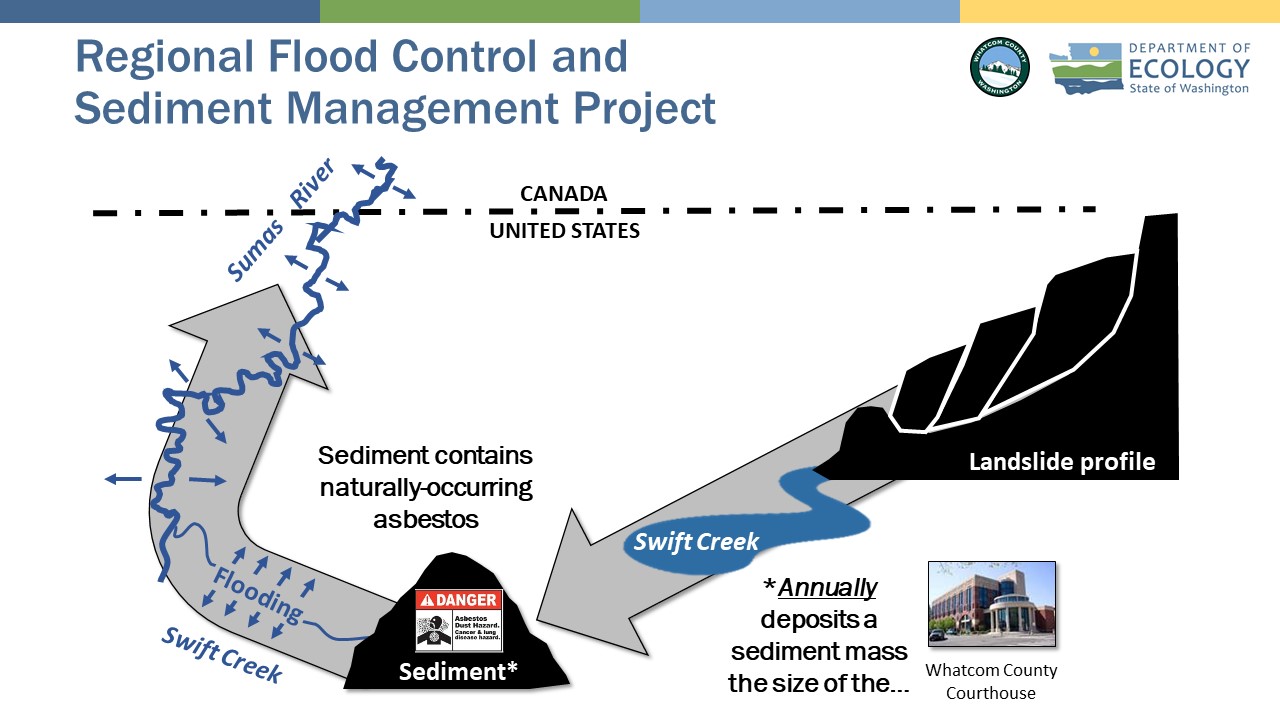
We CAN slow down Swift Creek, and we CAN minimize this unhealthy impact to the community.
Whatcom County went with the flow (streamflow, that is) instead of trying to stop the landslide.
They decided the best way to engineer this project was to slow the creek down and allow the sediment to settle out of the water in the creek’s upper reaches. Then the county will collect and safely store the asbestos-laden sediment in long-term repositories within the project area. To manage the dangerous dust, they will cover the collected sediment. After Swift Creek slowly navigates its new channel with new sediment traps and new settling basins, it joins the Sumas River with significantly less sediment.
To borrow a baseball analogy — they’re engineering a “double play” to deal with both the flooding AND the sediment!
Construction update
Swift Creek Project construction and engineering diagram 
Engineered controls listed below are generally by elevation from uphill to downhill and/or east to west (or right to left on above diagram).
Completed
- Oat Coles Repository Site: Storage location for Swift Creek sediment.
2021–2022
Example of new signs at project property gates 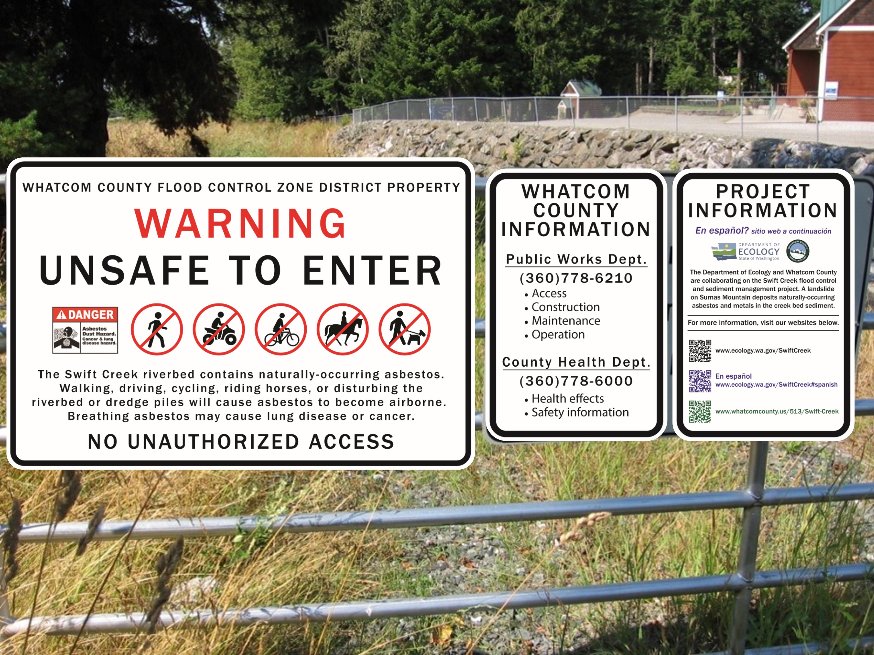
- Sediment Trap Project Area: System to slow Swift Creek water and allow sediment to settle before continuing downstream.
- Property Line Fence: New fence limiting public access to project area for safety and security.
- Conceptual Sediment Basins Area: System to slow Swift Creek water and allow sediment to settle for removal and storage in future sediment repositories.
- Interim Access Road: Temporary road for early project construction.
- Oat Coles South Wetland Mitigation Area: Wetland area to offset and counter other environmental effects from the Swift Creek Project construction.
2023–2024
Stormwater pond example 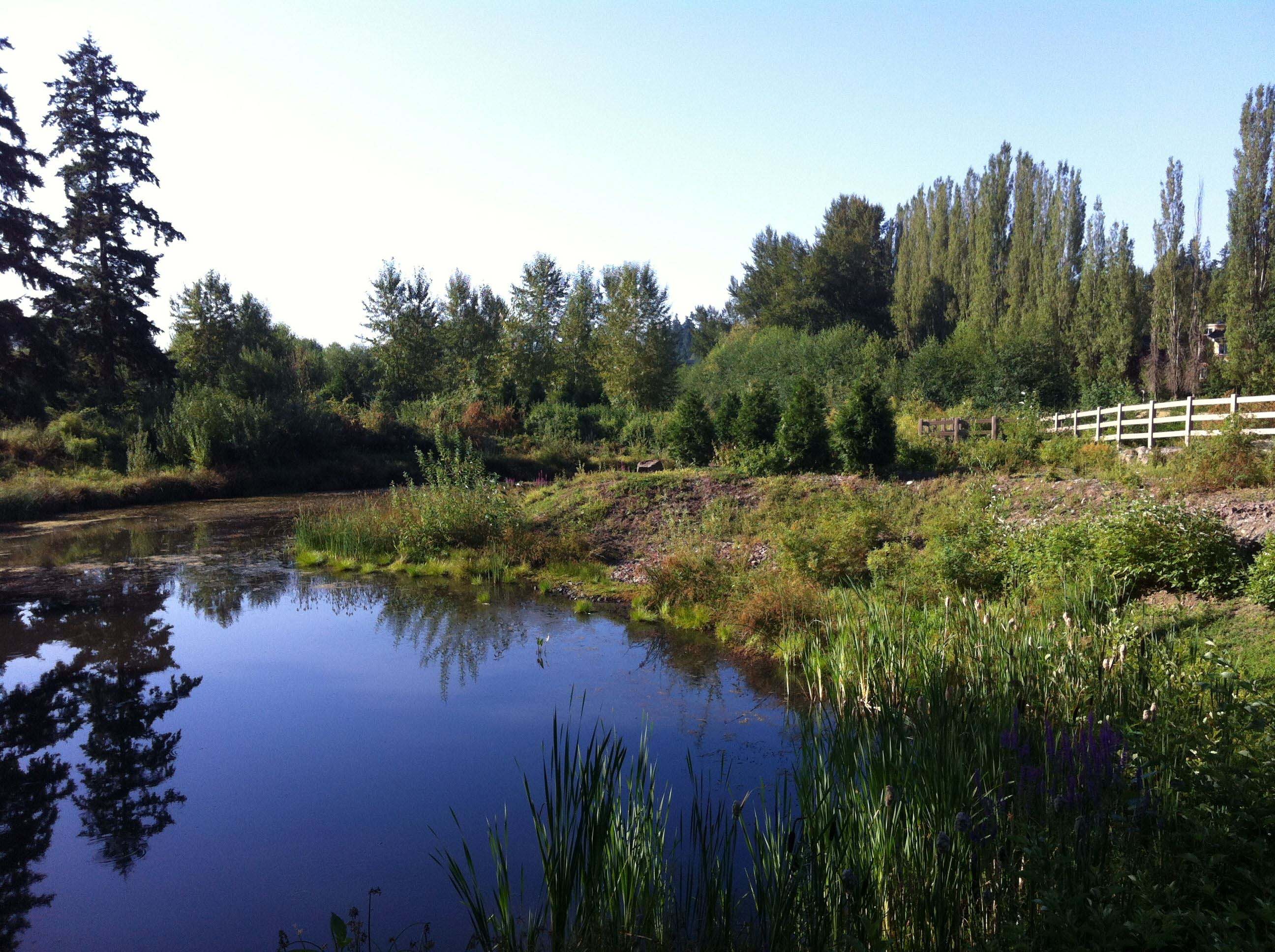
- Stormwater Sediment Pond: Catchment pool for runoff from future long-term sediment repositories.
- Overflow Deflection Berm: Engineered soil barrier for streamflow control during a flooding or landslide event. This engineered control is designed to function together with the Debris Flow Deflection Berm further upstream (see "Mixed construction schedule" below).
- Williams Pipeline Crossing Grade Control Structures: A natural gas pipeline flows under Swift Creek. This engineered system safely directs Swift Creek over the underground pipeline.
2025–2027
Sediment weir trap example 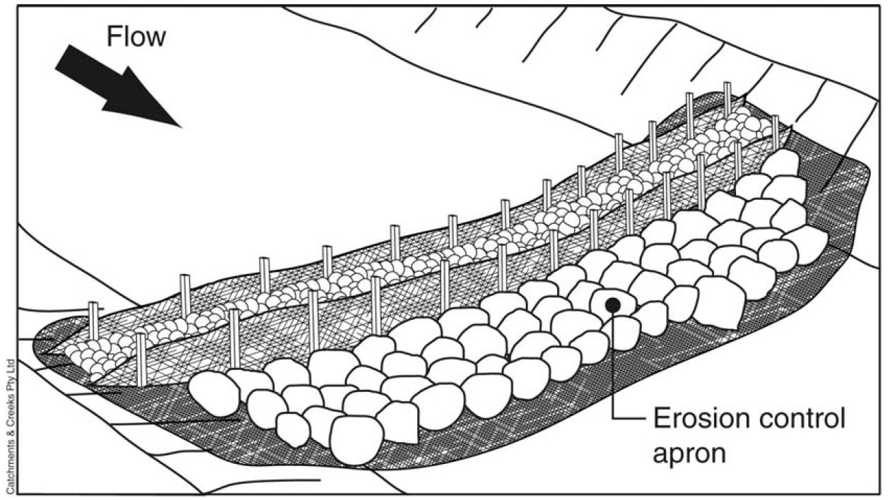
- 3-Stage Weir Annual Sediment Traps: System to slow Swift Creek water using a series of low dams to allow sediment to settle before continuing downstream. Sediment will be removed each year and stored in long-term sediment repositories.
- Potential Replacement Access Bridge: A bridge may be constructed upstream from the existing project area bridge over Swift Creek.
- Channel Realignment: Swift Creek will be temporarily realigned in two parallel channels connecting the creek to the sediment basins constructed earlier. This temporary realignment will enable the construction of the larger, long-term sediment basin area.
Sediment basin design examples 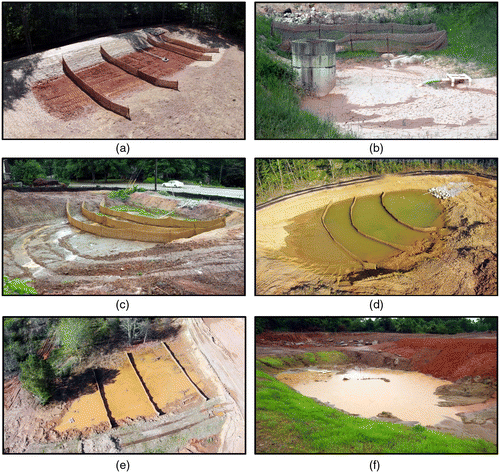
- Conceptual Sediment Basin Area: An approximately 30-acre engineered system to slow Swift Creek water using a series catchment channels and pools and allow sediment to settle for removal and storage in future sediment repositories.
- Lower Goodwin Reach Berm: Engineered soil barrier for streamflow control during a flooding or landslide event.
- Long-term Haul Road: Central access road for the duration of the project.
Mixed construction schedule
2024 and 2026–2027
- Canyon Central Repository Site: Long-term storage location for Swift Creek sediment.
- Canyon Central Clean Cover Stockpile and Repository Site: Long-term storage location for Swift Creek sediment. This location will also store clean soil, which will be used to cover sediment stored in long-term repositories.
2022 and 2025
Berm construction example 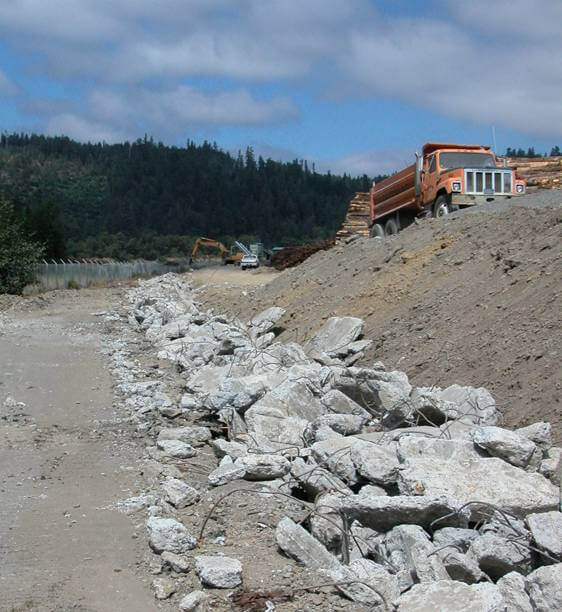
- Debris Flow Deflection Berm: Engineered soil barrier for streamflow control during a flooding or landslide event. Access roads will also be constructed on top of this berm.
It may have been a bit of an understatement when we said this corner of Whatcom County was about to look a “little different.”
A unique challenge requires a unique plan.