

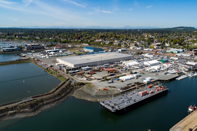
The Central Waterfront site of the Bellingham Bay cleanup is on course for cleanup construction to begin in 2026. In general, cleanup will be a combination of removing and capping contaminated soil, treating contaminated groundwater, safeguarding indoor air quality, monitoring effectiveness, and restricting certain land use activities — but we’re still filling out the details of those actions.
For the past few years, the cleanup partners — Ecology, the Port of Bellingham, and the City of Bellingham — have been collecting environmental data to prepare an Engineering Design Report for final cleanup of the site. This fall, scientists will be implementing a pilot study to treat contaminated groundwater before it enters Bellingham Bay. The pilot study will bring us one step closer to a final cleanup remedy for the site.
What investigations are happening at the site?
Enhanced in situ bioremediation (Source: EPA)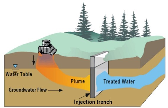
Groundwater treatment pilot study
A previous study found total petroleum hydrocarbon (TPH) concentrations in groundwater above site cleanup levels. We’re now beginning a pilot study to see if enhanced in situ bioremediation could effectively treat TPH-contaminated groundwater. This remediation technology speeds up the natural microbial breakdown of contaminants by adding nutrients underground along the general flow path of the groundwater.
The study will inject naturally occurring sulfate from filtered seawater and other nutrients into infiltration trenches over 12 months. Researchers will collect groundwater samples both before and during the study to evaluate the long-term effectiveness of this treatment technology.
Natural groundwater flow. (Source: US Geological Survey)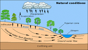
Evaluating groundwater quality
In conjunction with the groundwater treatment pilot study, additional samples and measurements will be taken from new and existing groundwater monitoring wells to evaluate groundwater quality and dynamics (such as flow direction, depth, and tidal influences). In addition, surface water and porewater (water in the pores of sediment) samples will be collected to evaluate the potential migration of contaminated groundwater to Bellingham Bay.
Aeration Stabilization Basin (ASB) treatment lagoon adjacent to the Central Waterfront cleanup site, May 2019.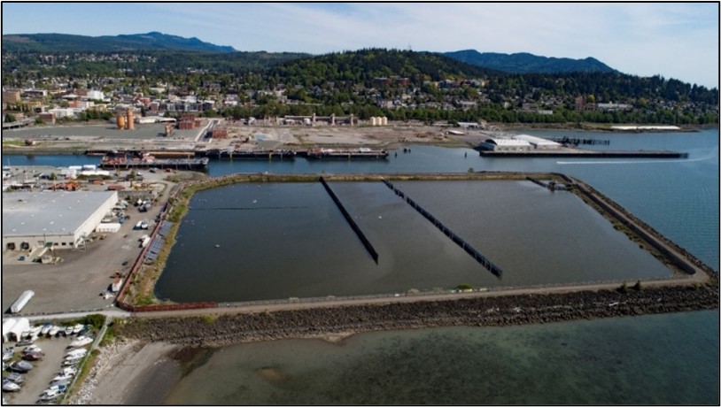
Evaluating groundwater dynamics
Adjacent to the Central Waterfront site is a large enclosed 28-acre treatment lagoon, called the Aeration Stabilization Basin (ASB). It was constructed in 1979 on top of a landfill to treat wastewater from Georgia-Pacific’s pulp mill. A large clay berm separates the basin from the Central Waterfront site and diverts the path of groundwater.
When the ASB is reconfigured during the future cleanup of the adjacent Whatcom Waterway site, the direction of contaminated groundwater flow will change. This study will collect data from wells within the footprint of the former landfill to understand current groundwater flow dynamics including how tidal fluctuations influence seasonal groundwater levels and how the clay berm affects groundwater movement.
Potential exposure pathways to landfill gas. (Source: Agency for Toxic Substances and Disease Registry)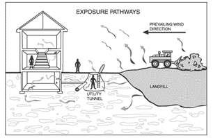
Assessing landfill gas and indoor air
The former Roeder Avenue Landfill at the Central Waterfront site produces landfill gas — mostly methane and carbon dioxide — as the solid waste breaks down. If left untreated, methane may accumulate to unsafe levels below the ground surface and migrate into utility trenches, basements, and buildings (see diagram).
During earlier investigations at the site, samples collected from soil-gas probes were high (above 5% methane). However, indoor air measurements did not indicate a threat to worker health and safety. With that information in mind, the current extent and levels of methane will be measured at existing soil-gas probes and in buildings located in the vicinity of the former landfill. Future development will likely include measures to prevent the migration of methane into building structures located at the Site.
Aerial example of surface conditions at the Central Waterfront cleanup site, May 2019.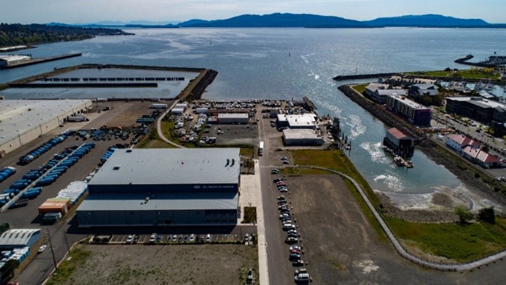
Assessing surface conditions
We want to make sure that people won’t come into direct contact with contaminated soil and that rainwater won’t carry contaminated soil into Bellingham Bay (via overland flow or storm drains). Technicians will walk the site, take photographs, and conduct detailed documentation of the various surfaces, such as asphalt, concrete, and buildings.
How is the cleanup funded?
The port and city are eligible for reimbursement of up to half of their cost from us through the state’s Remedial Action Grant Program, which helps pay for the cleanup of publicly-owned sites. The Legislature funds the grant program with revenues from a tax on hazardous substances.
Can I see the Central Waterfront cleanup site?
The Central Waterfront cleanup site is a busy marine waterfront with multiple businesses. Public access is available around this cleanup site via the approximately mile-long ASB Trail, just off Roeder Avenue. The path (leashed pets welcome!) juts out into the bay with awesome views. Head out there and you may see the current investigative work taking place!
How can I learn more about the Bellingham Bay cleanup?
The Central Waterfront site is one of 12 Bellingham Bay cleanup sites coordinated through the Bellingham Bay Demonstration Pilot. The pilot is a bay-wide multi-agency effort to clean up contaminated sediment, control sources of sediment contamination, and restore habitat, with consideration for land and water uses. Join our mailing list by emailing Kristen Forkeutis, Outreach Specialist.