

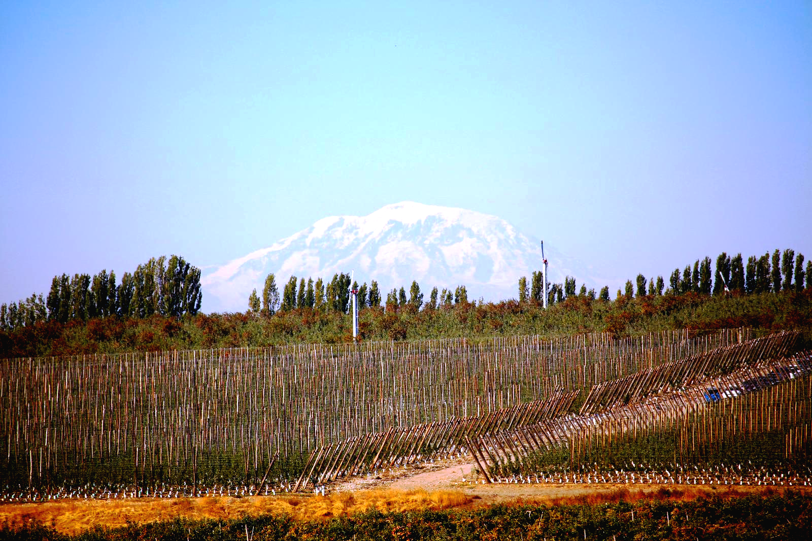
Mount Adams peeking above a Yakima Valley orchard
While the past two years working under a pandemic seemed like a blur, we continued to tackle the shifting forces of climate change on water supplies in the Yakima River Basin.
So far this year, cooler weather is holding water supplies in good stead with storage reservoirs filling and spring snow accumulating in the mountains. However, climate patterns are changing. And we know the future holds more uncertainty. We’re reminded of last summer’s heat dome, and years like 2015, when there was virtually no snowpack to rely upon.
This provides water managers impetus to adapt and use every drop of water wisely in an arid landscape where irrigation and fish compete for a finite resource.
As we shared in a July 2020 blog, enhanced water conservation is a key element of the Yakima Basin Integrated Plan. Projects are underway to improve and modernize agricultural and municipal water systems by increasing efficiencies, optimizing water management, and delivery methods.
Water conservation helps sockeye salmon thrive, and provides drought resiliency for farmers and communities alike. Still it is just one “spoke in the wheel” of an integrated approach to water management in a complicated river basin.
Recently, the Yakima Basin Integrated Plan work group met to take a deeper dive into understanding water conservation in this large watershed. That dive included a discussion on how surface and groundwater storage is a needed tool for making the most of conserved water.
Roadmap for water management
Building on decades of past water initiatives, Ecology, U.S. Bureau of Reclamation, Yakama Nation, irrigators, communities and fish interests, and others joined forces to adopt an over-arching road map, known as the Yakima River Basin Integrated Water Resource Management Plan, to guide water management in the basin over the next 30-plus years.
Overall goals of the Integrated Plan focus on one or more of these seven elements:
- Reservoir fish passage
- Structural and operational changes
- Enhanced water conservation
- Habitat/watershed protection & enhancement
- Groundwater storage
- Surface water storage
- Market reallocation (water banking & water markets)
What conservation have we achieved?
A drought in 1977 marked a pivotal point in the basin, with various efforts launched to examine water needs, including conservation and water right priorities.
Before and after: Conservation projects are helping to rewater tributaries like Manastash Creek, and providing water for both farms and fish
Since then, there have been myriad projects to improve water availability and efficiencies across the basin. Generally, these efforts were independent of one another, until basin leaders adopted the Integrated Plan. (See:" Where we've been - the specifics" below.)
Counted all together, conserved water from these projects totals more than 400,000-acre-feet, or something equivalent to another large storage reservoir.
So why is this not enough?
“Water conservation is extremely complicated,” said Walt Larrick, a consultant for the Yakima Basin Joint Board of Irrigators and formerly an assistant manager for Reclamation’s Yakima Water Enhancement Project. “While conservation allows us to be more efficient, it doesn’t create any more water.”
Moreover, that water is over-appropriated and the basin often operates at a deficit.
Climate impacts and response
Snowpack feeds a vast irrigation network, supporting a top agricultural economy of apples, grapes, hops, hay, mint, and potatoes in the Yakima River Basin. In addition, the watershed is home to important fish species, including sockeye salmon reintroduced by the Yakama Nation.
Reclamation’s Yakima Irrigation Project delivers approximately 2.3 million acre-feet of water for seasonal irrigation. Capacity at five project reservoirs totals just over 1 million acre-feet. Managed storage releases and natural runoff combine to meet demand.
Often referred to as the sixth reservoir, snow melts over the summer to make up for the balance not captured in storage. As the timing of this runoff shifts due to climate change, we need the additional flexibility to capture and re-time its release in the system to maximize benefits for fish and irrigators.
Maybe surprising to some, that means additional storage.
“Over the years we’ve been refining our operations, and working to achieve as much as we can with this conserved water,” explained Wendy Christensen, engineer and Reclamation’s Yakima Water Enhancement Project manager. “And we’re continuing with these investments through the Integrated Plan, with a goal of 85,000 acre-feet by 2029, and 170,000 for the full buildout of the Integrated Plan.”
If conserved water is to benefit streamflows for fish and assist farmers during low water years, it has to be available when needed most.
Sometimes that means a pulse flow released from reservoirs in early spring for salmon smolts leaving their home stream for the ocean or in mid-to-late summer when they return from the sea. At the same time, farms and communities need water when sources are literally drying up.
Increasing capacity at reservoirs
Conservation yields a large volume of water to help meet the Yakima Basin Integrated Plan’s goals of water reliability and drought resiliency, but we need more storage to get at least a 70% supply to irrigators whose diversions are drastically reduced or shut off when rationing of existing reservoirs begin.
These conditions are felt across the West, especially this year in the Klamath Basin of Southern Oregon and Northern California. All told, you cannot conserve your way out of the water supply shortages that we are facing under climate change.
Christensen noted that the Integrated Plan is looking at a number of new storage proposals and taking an accounting to identify a “baseline of what we have and optimize its use across the basin.”
Cle-Elum-Dam radial gates during construction when they were raised three feet in August 2019. Photo by Kirsten Strough, US Bureau of Reclamation
For instance, three feet added to the dam gates at Cle Elum Reservoir in the Central Cascades is increasing storage capacity by 14,600 acre-feet to supplement fish flows for the Cle Elum River to the Yakima River. In line with the integrated approach, construction of permanent fish passage also is underway at the dam.
“We are doing a lot of work related to surface water storage as part of the Integrated Plan and the projects have evolved over time,” Christensen said.
Among proposals studied is a floating pump option at Kachess Reservoir to access stored water that lies below the current outlet during drought years.
Long-term storage considerations include an off-channel site with in the Yakima River Canyon known as Wymer, and a proposal that could enlarge the Bumping Lake reservoir.
Kittitas Reclamation District is working on Upper Yakima System Storage and Yakima-Tieton Irrigation District has proposed a North Fork Cowiche Reservoir.
Important takeaways
“There’s no question water conservation is part of the solution,” Larrick said. “There’s also a need for storage to manage that conserved water.”
Additional storage will help provide the basin with the flexibility to capture runoff as the timing of snowmelt changes and more precipitation falls as rain. Hypothetically, as it sits now, we could have a very wet winter with most of the precipitation coming as rain and it would flow through the system before it could be beneficially used for irrigation or fish flows during the spring months.
“We’ve made tremendous progress, and the (irrigation) districts have plans they are working on to retime water for when we need it and we need to optimize storage to do so,” Larrick added.
There are three prongs to the approach for shaping water use, be it natural flows, stored, retimed, diverted or not diverted or conserved:
- To provide flows in the tributaries to support incoming spawning and outgoing migrating fish;
- To enhance (boost) natural flows in the lower mainstem by releasing water from the reservoirs;
- And to manage conserved water so it is available to farmers in years of drought and as a tool to respond to climate change.
With the future of snowpack at risk and with a goal of being both drought resilient for farmers and committed to the restoration of salmon, Integrated Plan partners recognize they can do more together than they had for decades on their own.
“Conservation gives us more flexibility to do more things,” said Jeff Tayer, retired Department of Fish & Wildlife Region 3 director. “And we’ve been able to do so much more in the context of the Integrated Plan with the cooperation of the farmers.”
Alone, the state Department of Fish and Wildlife, NOAA Fisheries, and Yakama Nation fisheries department's “pre-Integrated Plan were not able to achieve these needs,” he said.
Summing up, Melissa Downes with Ecology’s Office of Columbia River said water conservation “is interrelated to aquifer recharge and habitat restoration, combined with storage to retime where we’re placing and when we’re placing conserved water, and help threatened species in critical stream reaches.”
We are partnering with irrigators and municipal users and investing in low water use landscaping, advancing on-farm water application technology, sealing leaky irrigation canals, converting open ditches to piped systems, and upgraded water measurement devices all play a part in adapting to future climate scenarios and extending precious water supplies in the Yakima Basin.
All in relationship to the other elements of the Integrated Plan.
Where we've been — the specifics
While in the past conservation efforts largely benefitted either fish or farms, the integrated approach treats these water values equally.
In 1980, the state (Referendum 38) provided funding for conservation, and irrigation districts like Yakima-Tieton pressurized their entire system, which conserves 20,000 to 30,000 acre-feet of water.
In 1994, the Yakima Irrigation Project was required to recognize fish and wildlife as part of its purpose, and Congressional legislation that same year provided millions in funding for conservation projects, with two-thirds of the conserved water designated for streamflows to support fish, and one-third designated for irrigators during drought years.
Frankly, the split dampens the incentive for irrigators who too were facing shortages. Still, the program continues to be successful and proves to be a valuable tool. Sunnyside Valley Irrigation District’s project, for instance, will result in 47,000 acre-feet of conserved water for streamflows.
Other farm enhancements and district changes are ongoing, resulting in pumps, pressurized pipes, drip irrigation, and sprinklers replacing open ditches, flood irrigation, and leaking canals lined.
Eliminating the large water diversions at the former Wapatox power generating station in 2003 added 400 cubic feet per second (260,000 acre-feet) of water to 11 miles of the Naches River, a major tributary of the Yakima River.
The Enhanced Water Conservation element of the Integrated Plan builds on this conservation history in the basin.